MyTopo
Woodville Texas US Topo Map
Couldn't load pickup availability
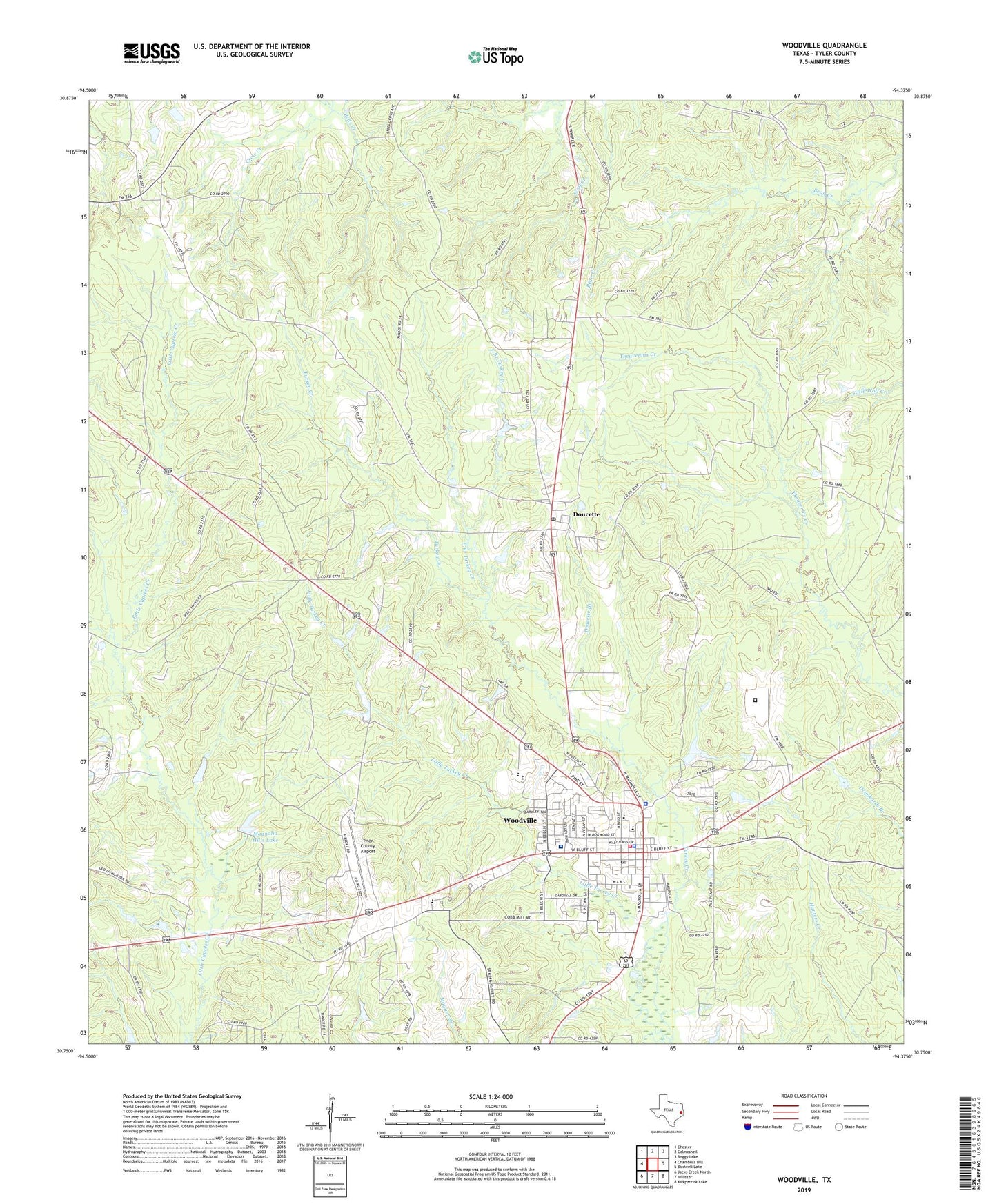
2022 topographic map quadrangle Woodville in the state of Texas. Scale: 1:24000. Based on the newly updated USGS 7.5' US Topo map series, this map is in the following counties: Tyler. The map contains contour data, water features, and other items you are used to seeing on USGS maps, but also has updated roads and other features. This is the next generation of topographic maps. Printed on high-quality waterproof paper with UV fade-resistant inks.
Quads adjacent to this one:
West: Chambliss Hill
Northwest: Chester
North: Colmesneil
Northeast: Boggy Lake
East: Birdwell Lake
Southeast: Kirkpatrick Lake
South: Hillister
Southwest: Jacks Creek North
This map covers the same area as the classic USGS quad with code o30094g4.
Contains the following named places: Barlow Chapel, Crow Creek, Dies Community, Dogwood Emergency Medical Service, Doucette, Doucette Branch, Doucette Post Office, Dunrovin Hatchery, East Branch Turkey Creek, Egypt Church, Faith Lutheran Church, Forest Lake, Forest Lake Dam, Haralson Lakes, Heritage Village Museum, Josiah Wheat Lake, Josiah Wheat Lake Dam, Little Turkey Creek, Magnolia Hills, Magnolia Hills Lake, Magnolia Hills Lake Dam, Our Lady of Pines Catholic Church, Texas Department of Criminal Justice Gib Lewis Unit, Town of Woodville, True Gospel Holiness Church, Tyler County, Tyler County Airport, Tyler County Constable Precinct 1, Tyler County Constable Precinct 2, Tyler County Constable Precinct 3, Tyler County Constable Precinct 4, Tyler County Courthouse, Tyler County Hospital, Tyler County Hospital Heliport, Tyler County Jail, Tyler County Sheriff's Office, Whites Chapel Church, Woodville, Woodville City Hall, Woodville Division, Woodville Elementary School, Woodville High School, Woodville Intermediate School, Woodville Police Department, Woodville Post Office, Woodville United Methodist Church, Woodville Volunteer Fire Department, ZIP Code: 75942