MyTopo
Liberty Mississippi US Topo Map
Couldn't load pickup availability
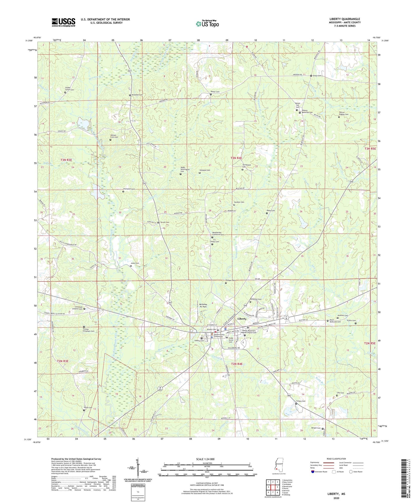
2020 topographic map quadrangle Liberty in the state of Mississippi. Scale: 1:24000. Based on the newly updated USGS 7.5' US Topo map series, this map is in the following counties: Amite. The map contains contour data, water features, and other items you are used to seeing on USGS maps, but also has updated roads and other features. This is the next generation of topographic maps. Printed on high-quality waterproof paper with UV fade-resistant inks.
Quads adjacent to this one:
West: Bewelcome
Northwest: Homochitto
North: Busy Corner
Northeast: Smithdale
East: Peoria
Southeast: Gillsburg
South: Street
Southwest: Berwick
Contains the following named places: Amite County, Amite County Courthouse, Amite County Sheriff's Office, Amite Lookout Tower, Anders Lake Dam, Andrews Cemetery, Bates Cemetery, Beall, Bryant Cemetery, Carroll Branch, Causey Cemetery, Cedar Grove Cemetery, Cedar Grove Church, Central High School, Cheatham Children Cemetery, Church of God of Prophecy, Days Creek, Dixon-McDowell Cemetery, Enterprise School, Gardner Cemetery, Gillespie Cemetery, Griffin Cemetery, Henderson Poultry Farm, House of Prayer Church, Jenkins Memorial Cemetery, Jones Cemetery, Kelly Branch, Lazy Creek, Liberty, Liberty Ambulance Service, Liberty Baptist Church, Liberty Cemetery, Liberty Elementary School, Liberty Missionary Baptist Church Cemetery, Liberty Police Department, Liberty Post Office, Liberty Rural Volunteer Fire Department, Liberty Sewage Lagoon Dam, Liberty Volunteer Fire Department, Lilly Cemetery, Love School, McDowell Cemetery, McGehee Air Park, McGehee Cemetery, Morgan Cemetery, Mount Zion Church, New Day Church, Newman Branch, North Central Volunteer Fire Department, Parker Cemetery, Parker School, Parson Hill Cemetery, Parson Hill Church, Plainview Church, R J Causey Cemetery, Saint Regis Paper Company Lake Dam, Sharp Cemetery, Sharp Lake Dam, Sharp Store, Sleeper Cemetery, Smith Cemetery, Speculation Creek, Stubbs - Carter Cemetery, Supervisor District 1, Tanyard Creek, Terrell Cemetery, Thomas Cheatham Cemetery, Thompson Cemetery, Town of Liberty, Turnipseed Cemetery, Warren Hughey Cemetery, Weathersby-Clairborne Cemetery, Webb - Whittington Cemetery, Webb Branch, William Frith Cemetery, Zion Hill Creek, ZIP Code: 39645