MyTopo
Berwick Mississippi US Topo Map
Couldn't load pickup availability
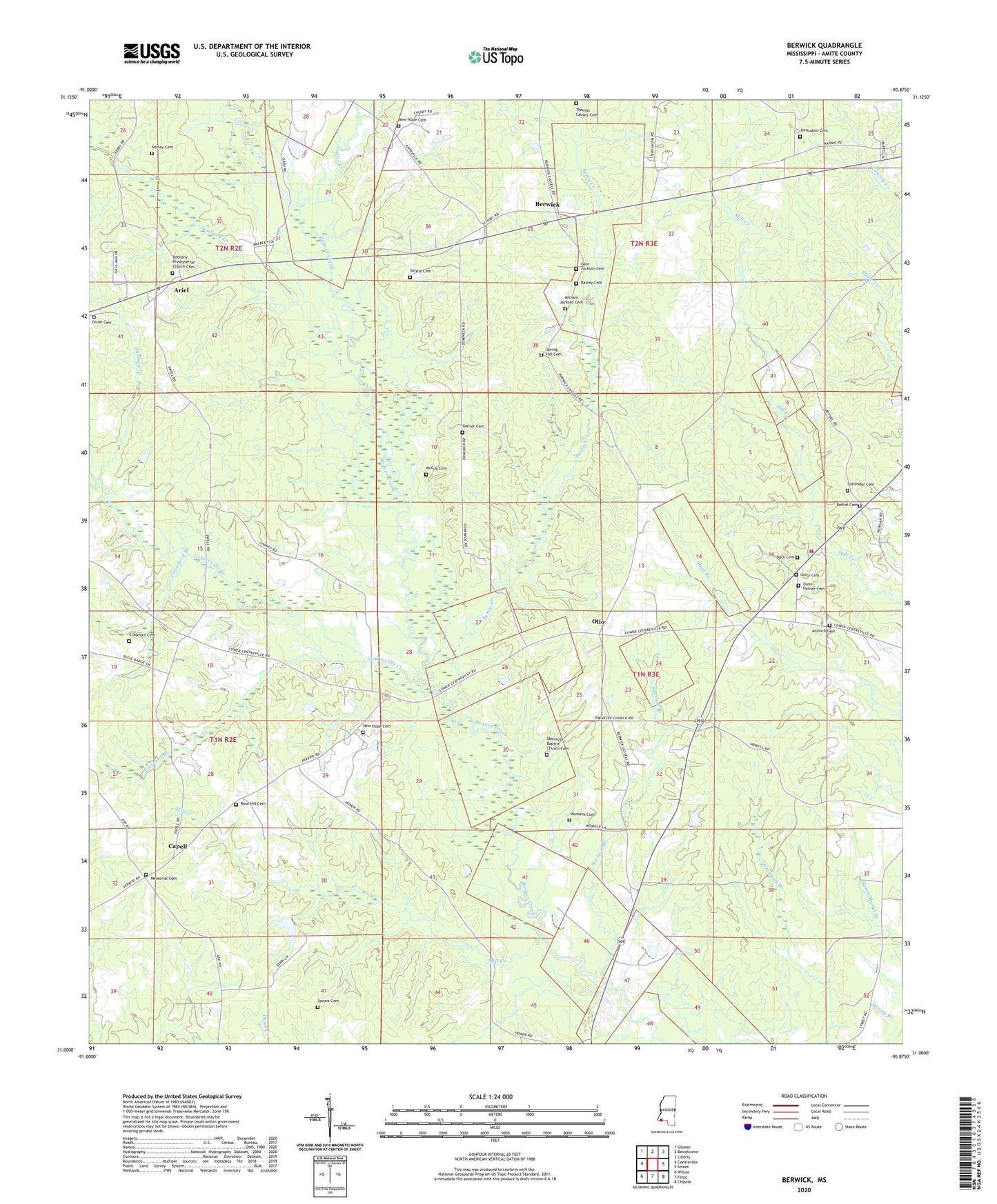
2024 topographic map quadrangle Berwick in the state of Mississippi. Scale: 1:24000. Based on the newly updated USGS 7.5' US Topo map series, this map is in the following counties: Amite. The map contains contour data, water features, and other items you are used to seeing on USGS maps, but also has updated roads and other features. This is the next generation of topographic maps. Printed on high-quality waterproof paper with UV fade-resistant inks.
Quads adjacent to this one:
West: Centreville
Northwest: Gloster
North: Bewelcome
Northeast: Liberty
East: Street
Southeast: Chipola
South: Felps
Southwest: Wilson
This map covers the same area as the classic USGS quad with code o31090a8.
Contains the following named places: Antioch Cemetery, Antioch Church, Ariel, Berry Creek, Berwick, Bethany Church, Bethany Institute, Bethany Presbyterian Church Cemetery, Bethel Baptist Church, Bethel Cemetery, Callender Cemetery, Capell, Centreville Creek, Crawford Branch, Crawford Cemetery, Dixon Cemetery, Duck Cemetery, Dunn - Hefner Cemetery, Ebenezer Baptist Church, Ebenezer Baptist Church Cemetery, Ebenezer Cemetery, Election Branch, Ellis Creek, Forest School, Garner Cemetery, Hermon Jackson Lake Dam, Hughes Store, Issac Jackson Cemetery, Jerusalem Cemetery, Jerusalem Church, John F Piker Lake Dam, McCoy Cemetery, Memorial Cemetery, Mill Creek, Millers Store, New Hope Baptist Church, New Hope Cemetery, New Hope Church, Olio, Rainey Cemetery, Ramsey Creek, Rose Hill Cemetery, Rose Hill Church, Saint Marys Church, Seabury Creek, Section Branch, Smiley Cemetery, Smylie Cemetery, Spears Cemetery, Spring Hill Cemetery, Spring Hill Church, Street Volunteer Fire Department, Supervisor District 2, Talbot School, Thomas Causey Cemetery, Tolers, Unity Cemetery, Unity Church, White Store, William Jackson Cemetery, Womack Cemetery