MyTopo
Kiln Mississippi US Topo Map
Couldn't load pickup availability
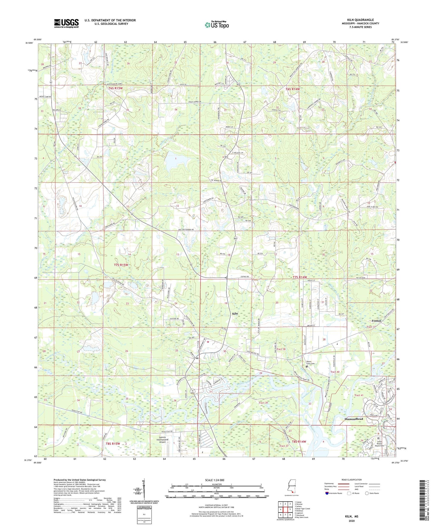
2024 topographic map quadrangle Kiln in the state of Mississippi. Scale: 1:24000. Based on the newly updated USGS 7.5' US Topo map series, this map is in the following counties: Hancock. The map contains contour data, water features, and other items you are used to seeing on USGS maps, but also has updated roads and other features. This is the next generation of topographic maps. Printed on high-quality waterproof paper with UV fade-resistant inks.
Quads adjacent to this one:
West: Dead Tiger Creek
Northwest: Caesar
North: Necaise
Northeast: Sellers
East: Dedeaux
Southeast: Bay Saint Louis
South: Waveland
Southwest: Logtown
This map covers the same area as the classic USGS quad with code o30089d4.
Contains the following named places: A Hoda Lake Dam, Annunciation Catholic Church, Bayou Coco, Bayou Coco Cemetery, Bayou Talla, Bayou Talla Boat Ramp, Bayou Talla Fellowship Church, Catahoula, Catahoula Church, Catahoula School, Diamondhead Baptist Church, Diamondhead Community Church, Diamondhead Sheriff's Substation, Diamondhead United Methodist Church, Faith Assembly of God Church, Fenton, Hancock County, Hancock County Library - Kiln Public Library, Hancock County Sheriff's Department, Kiln, Kiln Census Designated Place, Kiln Post Office, Kiln School, Kiln Volunteer Fire Department, Lady of the Pines Church, Little Providence Church, Little Rotten Bayou Cemetery, Mallini Bayou, Mississippi No Name 53 Dam, Orphan Creek, Pigeon Roost Branch, Rotten Bayou, Saint Edwards Church, Saint Thomas Episcopal Church, Silver Creek Acres, Supervisor District 4, Supervisor District 5, Thompsons Mill, Wiehe, Woodland Village Nursing Center, ZIP Code: 39556