MyTopo
Marietta Mississippi US Topo Map
Couldn't load pickup availability
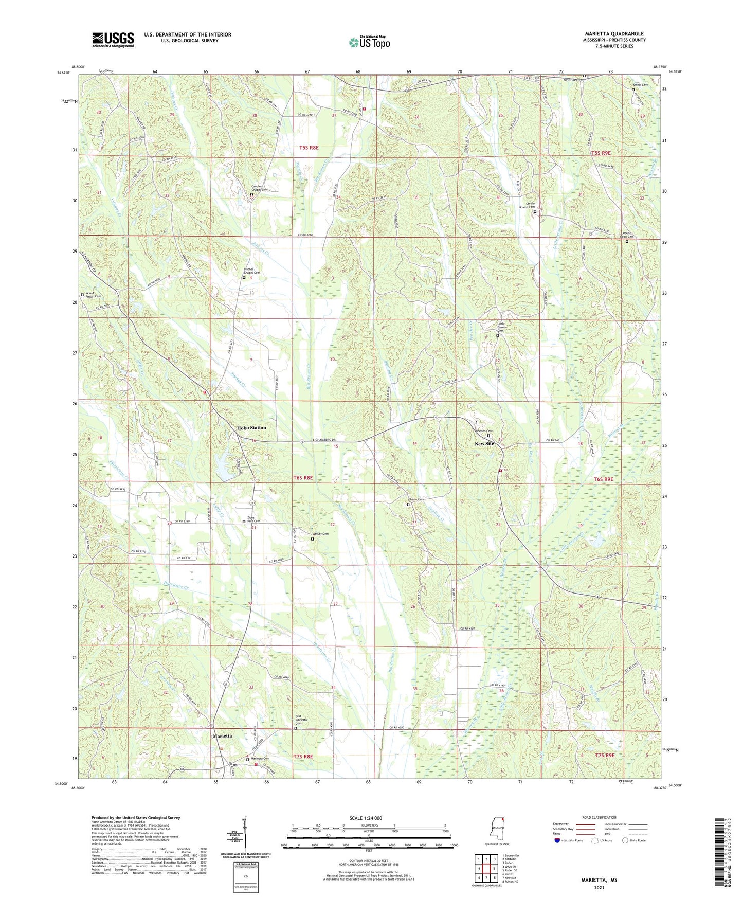
2021 topographic map quadrangle Marietta in the state of Mississippi. Scale: 1:24000. Based on the newly updated USGS 7.5' US Topo map series, this map is in the following counties: Prentiss. The map contains contour data, water features, and other items you are used to seeing on USGS maps, but also has updated roads and other features. This is the next generation of topographic maps. Printed on high-quality waterproof paper with UV fade-resistant inks.
Quads adjacent to this one:
West: Wheeler
Northwest: Booneville
North: Altitude
Northeast: Paden
East: Paden SE
Southeast: Fulton NE
South: Kirkville
Southwest: Ratliff
Contains the following named places: Big Brown Creek Church, Blythes Chapel, Blythes Chapel Cemetery, Blythes Chapel School, Bunkom Hill - New Hope Volunteer Fire Department, Candlers Chapel, Candlers Chapel Cemetery, Depoyster Lake Dam, East Marietta Cemetery, East Marietta Church, Hazel Green, Hobo - Big V Fire Department, Hobo Station, Hurricane Creek, Jenkins Creek, Little Brown Cemetery, Little Brown Church, Little Brown Creek Freewill Baptist Church, Little Creek, Little Creek Church, Little Jensay Creek, Marietta, Marietta Cemetery, Marietta Church, Marietta Lookout Tower, Marietta Post Office, Marietta Volunteer Fire Department, Martin Creek, Massey Cemetery, Mount Nebo Cemetery, Mount Nebo Church, Mount Pisgah Cemetery, Mount Pisgah Church, New Bethel Church of Christ, New Hope Cemetery, New Site, New Site Baptist Church, New Site Census Designated Place, New Site High School, New Site Volunteer Fire Department, Pee Dee Creek, Rhoads Cemetery, Roaring Hollow Church, Sapling Creek, Siloam Cemetery, Siloam Church, Smith Cemetery, Smith-Howell Cemetery, Supervisor District 4, Youngs Creek, Zions Rest Cemetery, Zions Rest Church, Zions Rest School, ZIP Code: 38859