MyTopo
Paden Mississippi US Topo Map
Couldn't load pickup availability
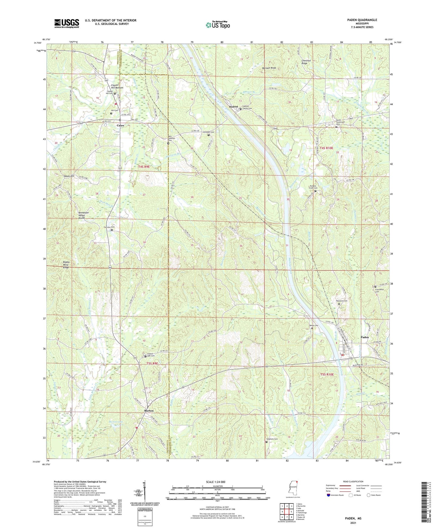
2024 topographic map quadrangle Paden in the state of Mississippi. Scale: 1:24000. Based on the newly updated USGS 7.5' US Topo map series, this map is in the following counties: Tishomingo, Prentiss. The map contains contour data, water features, and other items you are used to seeing on USGS maps, but also has updated roads and other features. This is the next generation of topographic maps. Printed on high-quality waterproof paper with UV fade-resistant inks.
Quads adjacent to this one:
West: Altitude
Northwest: Glens
North: Burnsville
Northeast: Iuka
East: Tishomingo
Southeast: Belmont
South: Paden SE
Southwest: Marietta
This map covers the same area as the classic USGS quad with code o34088f3.
Contains the following named places: Barnett Branch, Barnett Knob, Belue Cemetery, Black Branch, Burgess Creek, Burgess Creek Church, Burnt Mills Post Office, Burton, Burton Lake, Burton Volunteer Fire Department, Burton-New Hope Grammar School, Cairo, Cairo Volunteer Fire Department, Clausel Creek, Clausel Hill Bottom, Clausel Hill Cemetery, Clausel Hill Church, Clausel Hill School, Crossroads Church, Dead Man Branch, Divide Overlook Area, Fairview Cemetery, Fairview Church, Forked Oak Cemetery, Forked Oak Church, Friendship Church, Hill Cemetery, Holcut, Holcut School, Hurrican Branch, Hurricane Creek, King Creek, Lambert Chapel, Liberty School, Mackys Creek Canal, New Lebanon Cemetery, New Lebanon Church, Odom Hill, Paden, Paden Fire Department, Paden High School, Paden Overlook Area, Palestine Cemetery, Palestine Church, Panther Creek, Pollard Mill Branch, Reedy Branch, Shady Grove Church, South Crossroads Cemetery, Stephens Cemetery, Stricklen Cemetery, Village of Paden