MyTopo
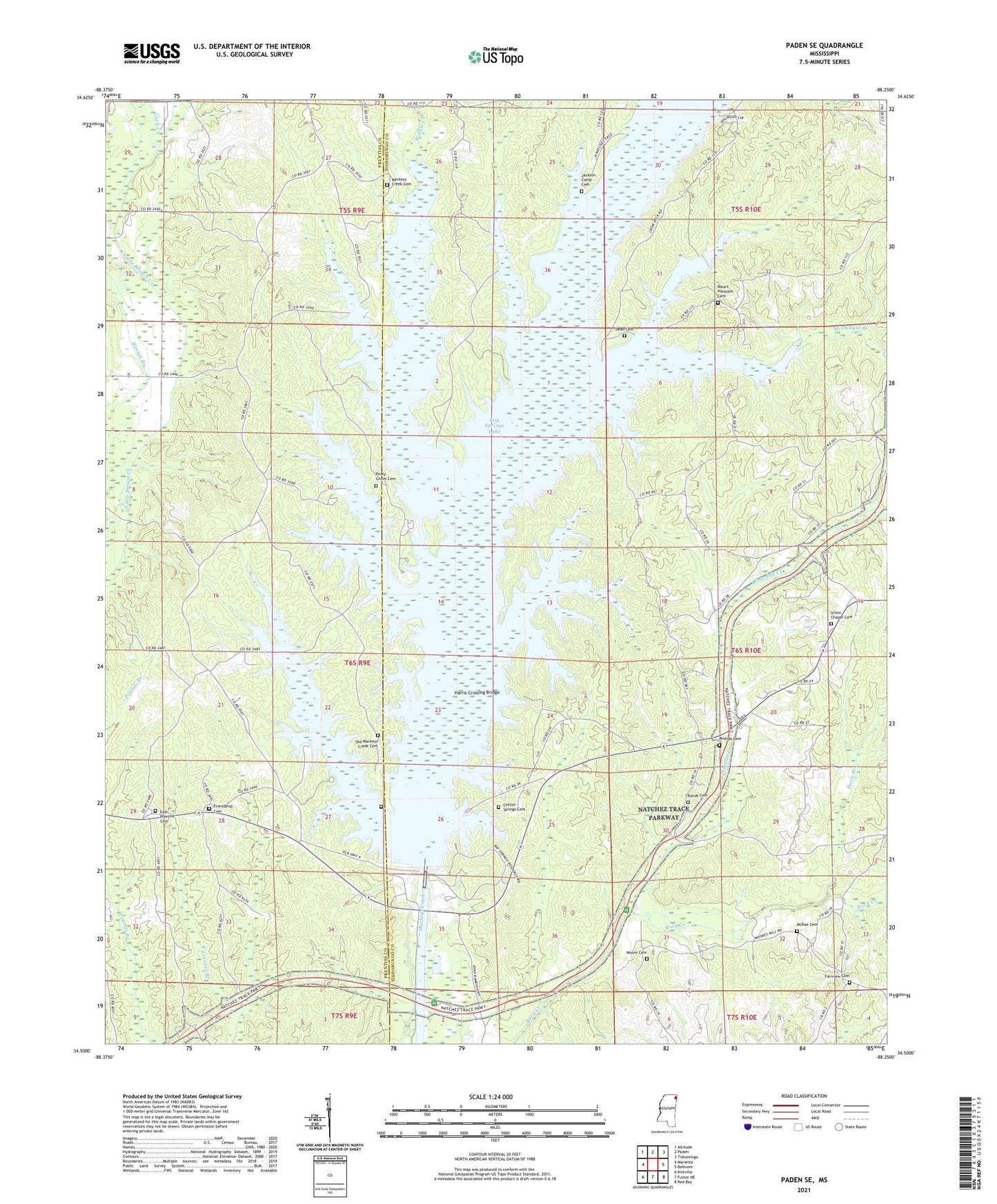
Paden SE Mississippi US Topo Map
Couldn't load pickup availability
2024 topographic map quadrangle Paden SE in the state of Mississippi. Scale: 1:24000. Based on the newly updated USGS 7.5' US Topo map series, this map is in the following counties: Tishomingo, Prentiss. The map contains contour data, water features, and other items you are used to seeing on USGS maps, but also has updated roads and other features. This is the next generation of topographic maps. Printed on high-quality waterproof paper with UV fade-resistant inks.
Quads adjacent to this one:
West: Marietta
Northwest: Altitude
North: Paden
Northeast: Tishomingo
East: Belmont
Southeast: Red Bay
South: Fulton NE
Southwest: Kirkville
This map covers the same area as the classic USGS quad with code o34088e3.
Contains the following named places: Allen Line, Allen Line School, Barnes Store Post Office, Bay Springs, Bay Springs Church, Bay Springs Lake, Bay Springs Lock and Dam, Billingsley School, Bonds Cemetery, Brumley Cemetery, Cape Fair, Cotton Springs Cemetery, Cotton Springs School, Crows Neck Recreation and Environmental Center, Damsite Recreation Area, Dean Cemetery, East Prentiss, East Prentiss Cemetery, East Prentiss Church, East Prentiss School, Fairview Cemetery, Fairview Church, Friendship Cemetery, Friendship Church, Friendship School, Harris Crossing Bridge, Hillside Post Office, Hunt Post Office, Jackson Camp Cemetery, Jackson Camp Recreation Area, Jacksons Camp Church, Jordan Hill Church, Jourdan Creek, Lacy Creek, Mackeys Creek Cemetery, Mackeys Creek Church, Mackeys Creek Primitive Baptist Church, Mackeys Recreation Area, McDougal Branch, McRae Cemetery, Mineral Springs School, Moore Cemetery, Mount Pleasant Cemetery, Mount Pleasant Church, Mount Pleasant School, Mount Zion Church, Natchez Trace Recreation Area, New Bethel Church, Old Mackeys Creek Cemetery, Old Mackies Creek Church, Pardue, Perry Branch, Phillips Cemetery, Piney Grove Cemetery, Piney Grove Recreation Area, Riddle Creek, Sandy Hook Creek, Stevens Arbor School, Supervisor District 5, Trollinger Cemetery, Tynes Post Office, Union Chapel, Union Chapel Cemetery, ZIP Code: 38838


