MyTopo
Fulton NE Mississippi US Topo Map
Couldn't load pickup availability
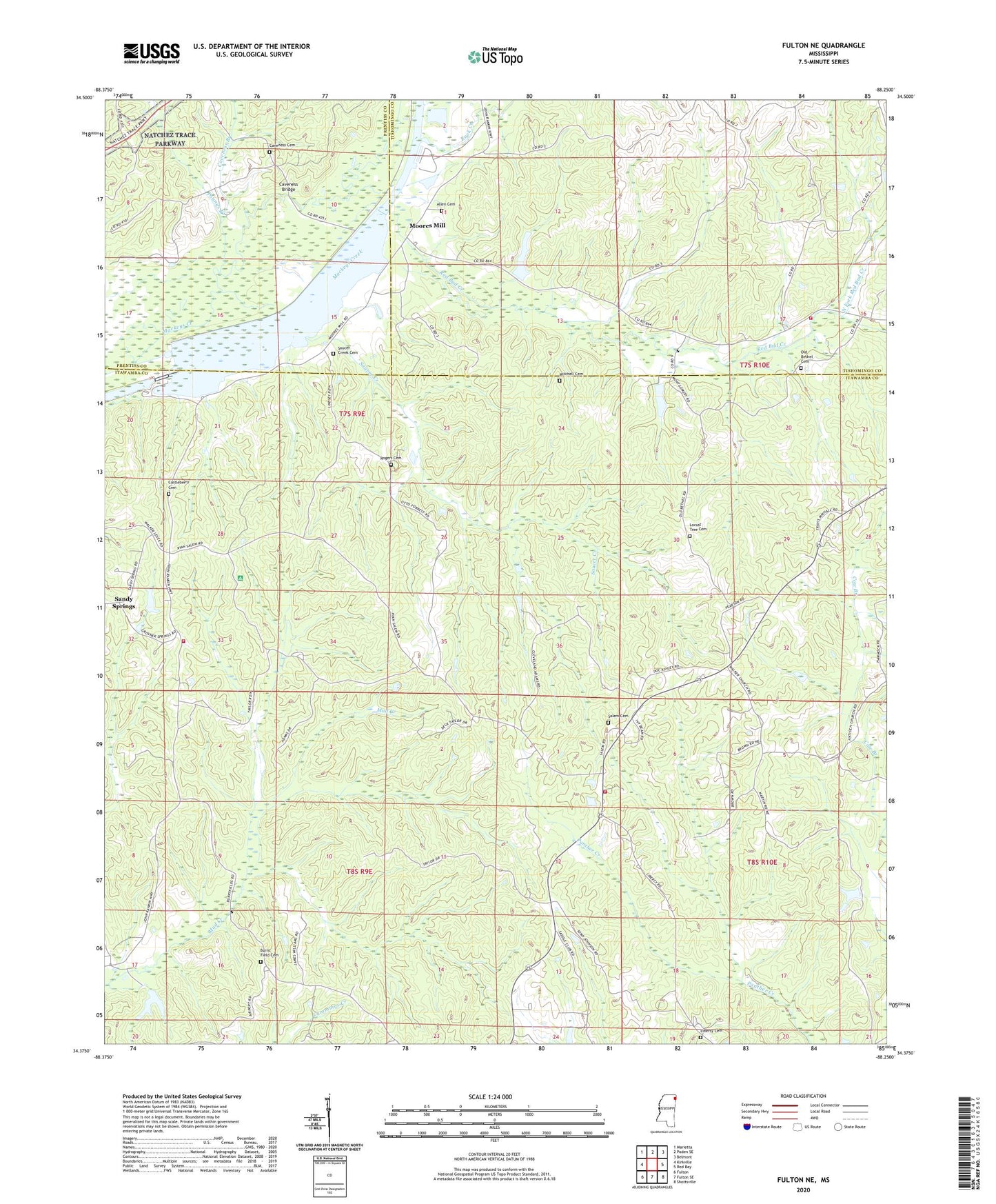
2024 topographic map quadrangle Fulton NE in the state of Mississippi. Scale: 1:24000. Based on the newly updated USGS 7.5' US Topo map series, this map is in the following counties: Itawamba, Tishomingo, Prentiss. The map contains contour data, water features, and other items you are used to seeing on USGS maps, but also has updated roads and other features. This is the next generation of topographic maps. Printed on high-quality waterproof paper with UV fade-resistant inks.
Quads adjacent to this one:
West: Kirkville
Northwest: Marietta
North: Paden SE
Northeast: Belmont
East: Red Bay
Southeast: Shottsville
South: Fulton SE
Southwest: Fulton
This map covers the same area as the classic USGS quad with code o34088d3.
Contains the following named places: Allen Cemetery, Allens Chapel, Bethany Church, Burnt Field Cemetery, Burnt Fields Church, Castleberry Cemetery, Caveness Branch, Caveness Bridge, Caveness Cemetery, Cliff, Cow Branch, Credille Dam, Guy Senter Pond Dam, Liberty Cemetery, Locust Tree Cemetery, Locust Tree School, Lunch, Mitchell Cemetery, Moores Mill, Neil Page Pond Dam, New Bethel School, North Fork Red Bud Creek, Northeast Itawamba Volunteer Fire Department, Old Bethel, Old Bethel Cemetery, Old Bethel Church, Pharr School, Pounds Branch, Red Bud Church, Red Bud Creek, Red Bud School, Rock Creek, Rogers Cemetery, Ryans Well, Ryans Well Volunteer Fire Department Station 1, Salem Cemetery, Salem Church, Saucer Creek, Saucer Creek Cemetery, Saucer Creek Church, Saucer Creek Recreation Area, South Fork Red Bud Creek, South Tishomingo Fire Department, South Tishomingo School, Supervisor District 1, Travis South Lake Dam, Voy, Wadell Lake Dam, Walker House Church, Warrens Mill