
MyTopo
Mashulaville Mississippi US Topo Map
Couldn't load pickup availability
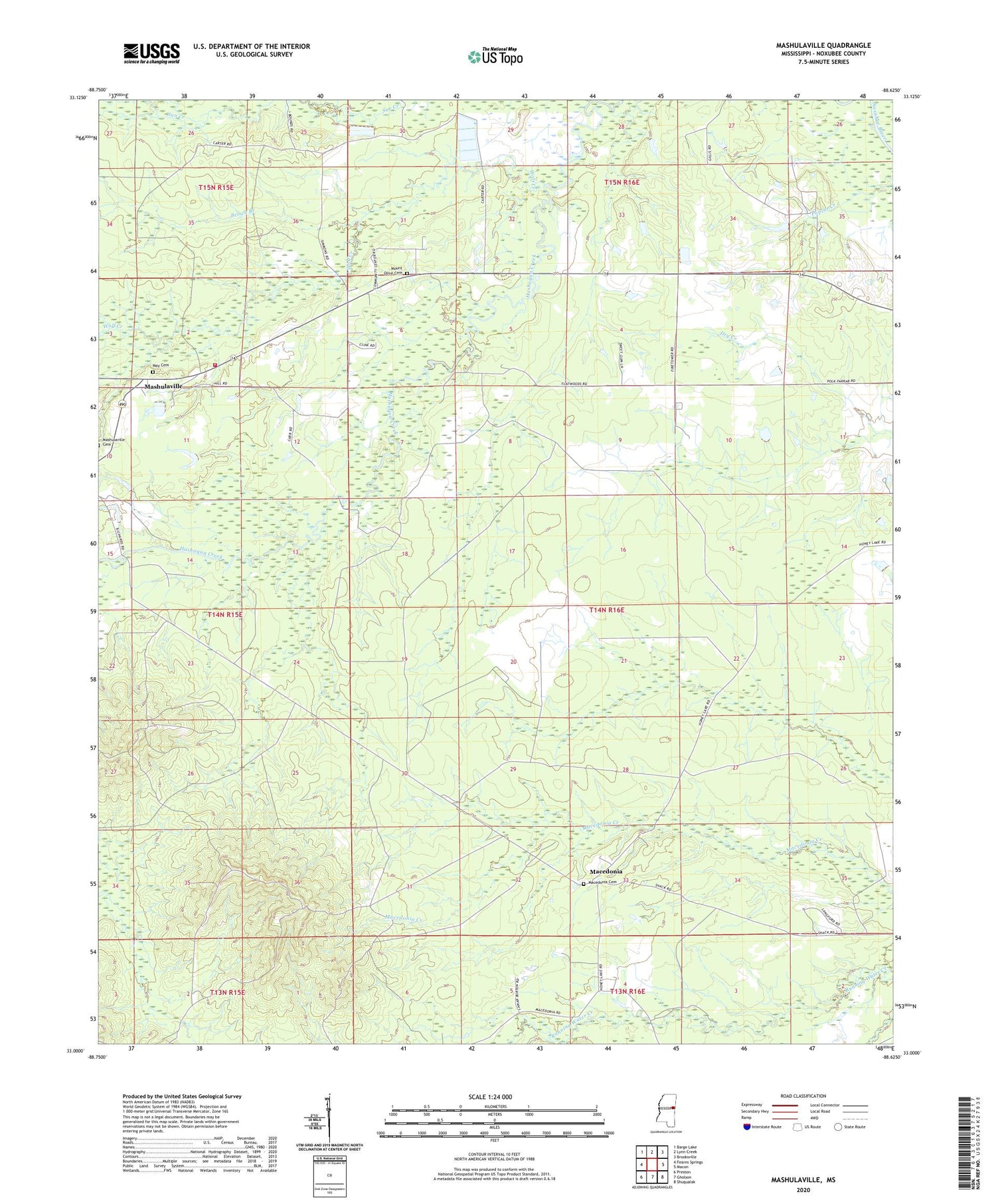
2020 topographic map quadrangle Mashulaville in the state of Mississippi. Scale: 1:24000. Based on the newly updated USGS 7.5' US Topo map series, this map is in the following counties: Noxubee. The map contains contour data, water features, and other items you are used to seeing on USGS maps, but also has updated roads and other features. This is the next generation of topographic maps. Printed on high-quality waterproof paper with UV fade-resistant inks.
Quads adjacent to this one:
West: Fearns Springs
Northwest: Barge Lake
North: Lynn Creek
Northeast: Brooksville
East: Macon
Southeast: Shuqualak
South: Gholson
Southwest: Preston
Contains the following named places: Brown Branch, Macedonia, Macedonia Cemetery, Macedonia Church, Mashulaville, Mashulaville Church, Mashulaville Community Center, Mashulaville Fire Station, May Cemetery, May Spring, Mount Moriah Church, Mount Olive Cemetery, Mount Olive Church, New Salem Church, Noxubee Lookout Tower, Oak Leaf Church, SEARAY Target Range Complex, Supervisor District 4, Upper Running Water Church, Wolf Creek


