MyTopo
Shuqualak Mississippi US Topo Map
Couldn't load pickup availability
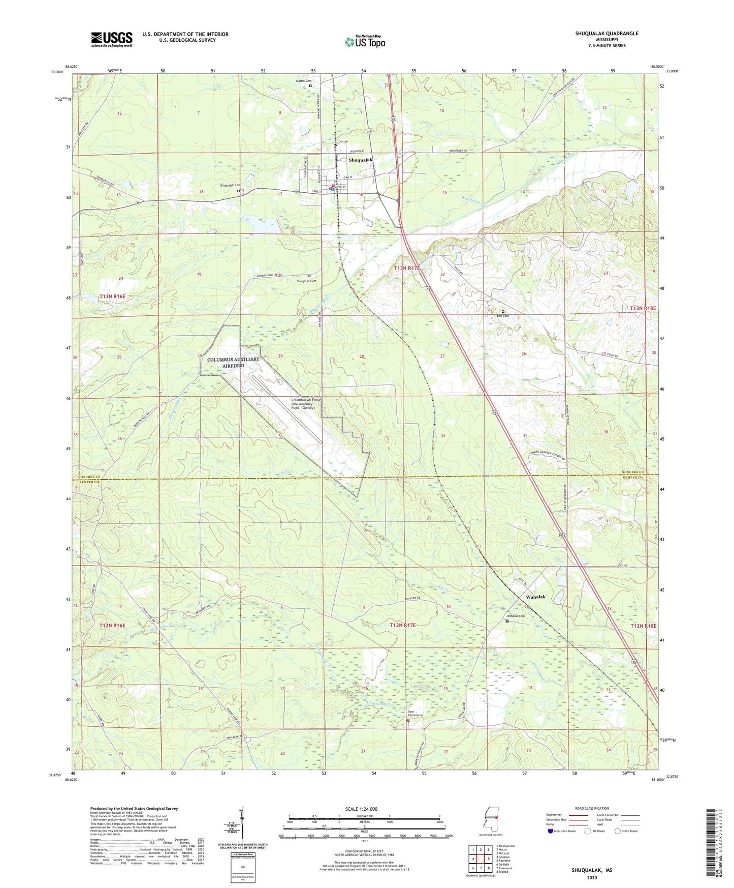
2024 topographic map quadrangle Shuqualak in the state of Mississippi. Scale: 1:24000. Based on the newly updated USGS 7.5' US Topo map series, this map is in the following counties: Noxubee, Kemper. The map contains contour data, water features, and other items you are used to seeing on USGS maps, but also has updated roads and other features. This is the next generation of topographic maps. Printed on high-quality waterproof paper with UV fade-resistant inks.
Quads adjacent to this one:
West: Gholson
Northwest: Mashulaville
North: Macon
Northeast: McLeod
East: Paulette
Southeast: Scooba
South: Townsend
Southwest: De Kalb
This map covers the same area as the classic USGS quad with code o32088h5.
Contains the following named places: Anderson Lake Dam, Bell Cemetery, Columbus Air Force Base Auxiliary Field (Gunshy), Goolsby Creek, Martin Cemetery, New Chapel Church, Shiloh Church, Shuqualak, Shuqualak Cemetery, Shuqualak Police Department, Shuqualak Post Office, Shuqualak Volunteer Fire Department, Sid Creek, Skipper Lake Dam, Slaughter Cemetery, Town of Shuqualak, Twin Cemeteries, Wahalak, Wahalak Cemetery, Wahalak First Baptist Church, Windhams Creek, ZIP Code: 39361