
MyTopo
Preston Mississippi US Topo Map
Couldn't load pickup availability
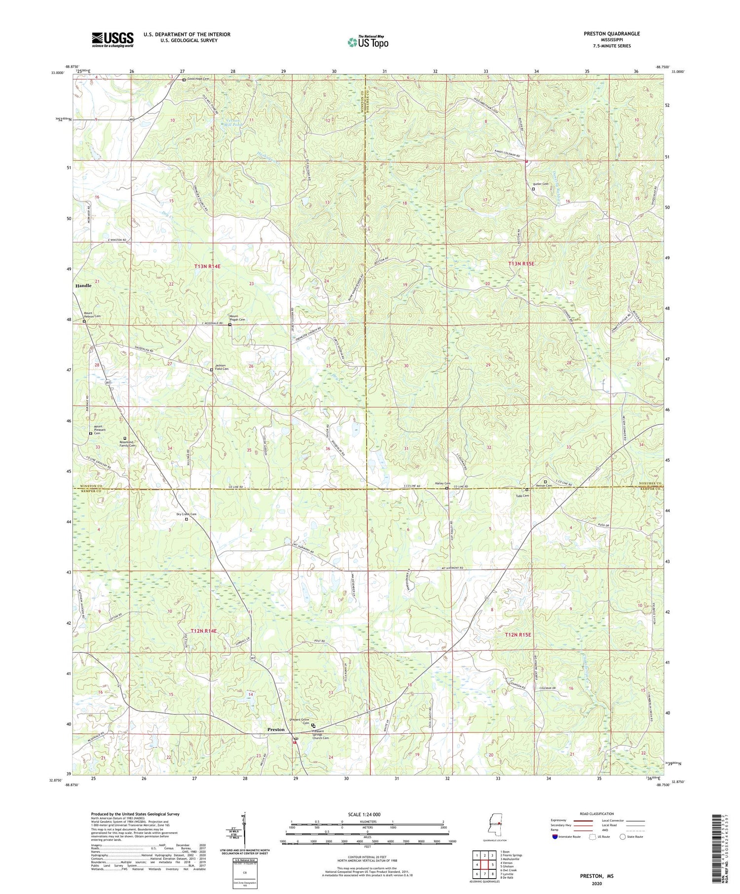
2024 topographic map quadrangle Preston in the state of Mississippi. Scale: 1:24000. Based on the newly updated USGS 7.5' US Topo map series, this map is in the following counties: Kemper, Noxubee, Winston. The map contains contour data, water features, and other items you are used to seeing on USGS maps, but also has updated roads and other features. This is the next generation of topographic maps. Printed on high-quality waterproof paper with UV fade-resistant inks.
Quads adjacent to this one:
West: Vernon
Northwest: Boon
North: Fearns Springs
Northeast: Mashulaville
East: Gholson
Southeast: De Kalb
South: Lynville
Southwest: Owl Creek
This map covers the same area as the classic USGS quad with code o32088h7.
Contains the following named places: Andersons Mill, Boys Ranch Lake Dam, Butler Cemetery, Butler Church, Church of God, Dry Creek Cemetery, Dry Creek Church, Ebenezer Church, Factory Church, Good Hope Baptist Church Cemetery, Good Hope Church, Hailey Cemetery, Haines Mill, Handle, Hashuqua, Jackson Field Cemetery, Jackson Field Church, Johnsons Store, Mill Lake Dam, Mission Ridge Church, Mount Hebron Cemetery, Mount Hebron Church, Mount Pisgah Cemetery, Mount Pisgah Church, Mount Pleasant Cemetery, Pleasant Springs Church, Pleasant Springs Church Cemetery, Preston, Preston Fire Department, Preston Post Office, Preston School, Rosamond Family Cemetery, Shepard Grove Cemetery, Southwest Fire Department, Tubb Cemetery, Vernon Cemetery, Vernon Church, Vernon Mill Pond, ZIP Code: 39354


