MyTopo
Gholson Mississippi US Topo Map
Couldn't load pickup availability
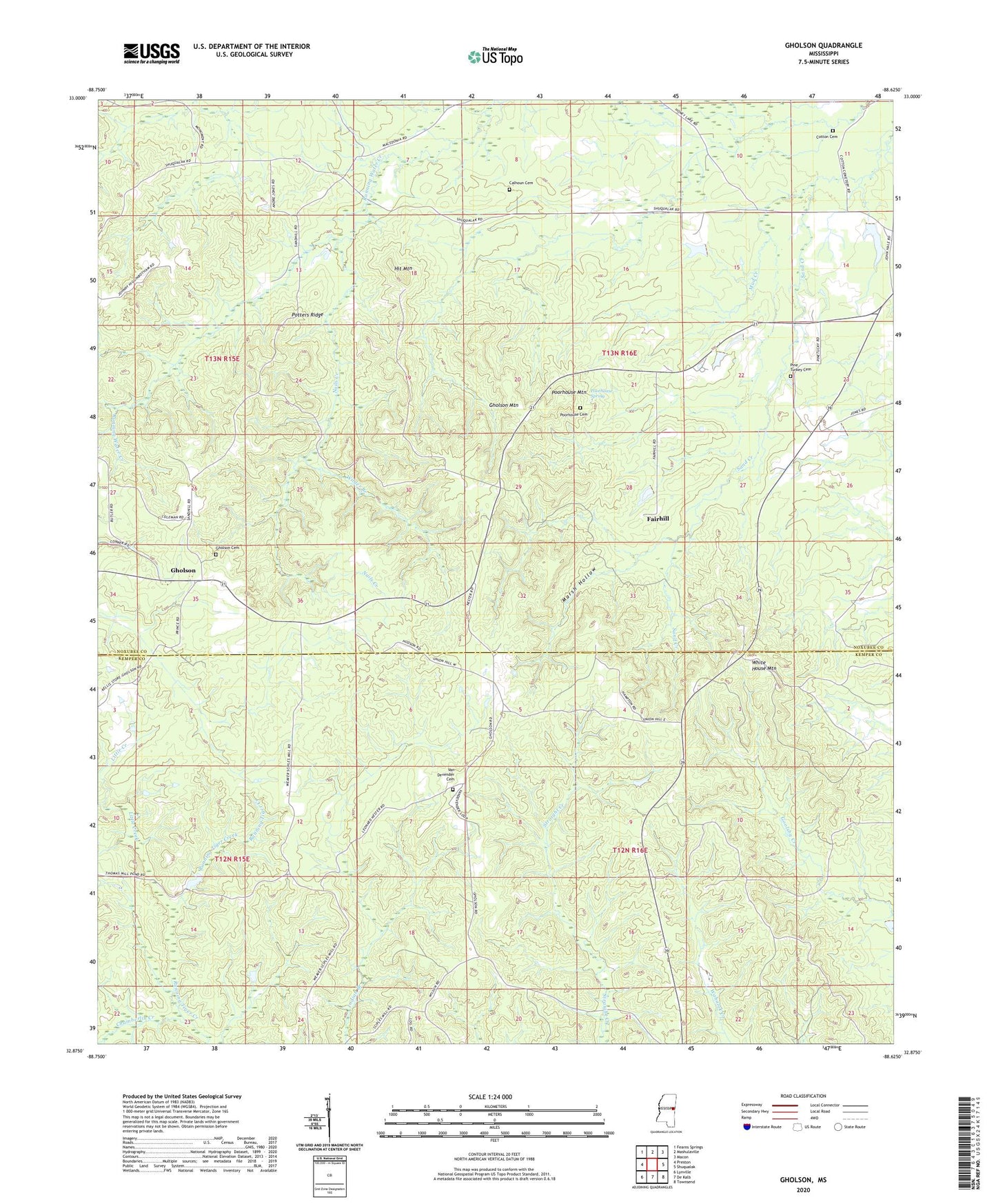
2024 topographic map quadrangle Gholson in the state of Mississippi. Scale: 1:24000. Based on the newly updated USGS 7.5' US Topo map series, this map is in the following counties: Noxubee, Kemper. The map contains contour data, water features, and other items you are used to seeing on USGS maps, but also has updated roads and other features. This is the next generation of topographic maps. Printed on high-quality waterproof paper with UV fade-resistant inks.
Quads adjacent to this one:
West: Preston
Northwest: Fearns Springs
North: Mashulaville
Northeast: Macon
East: Shuqualak
Southeast: Townsend
South: De Kalb
Southwest: Lynville
This map covers the same area as the classic USGS quad with code o32088h6.
Contains the following named places: Calhoun Cemetery, Calvary Church, Chamberlin Creek, Clearman, Clermont Church, Cotton Cemetery, Fairhill, Friendship Church, Gholson, Gholson Cemetery, Gholson Mountain, Hit Mountain, Little Creek, Marsh Hollow, Mud Creek, Nails Creek, Pine Turkey Cemetery, Poorhouse Cemetery, Poorhouse Mountain, Poorhouse Spring, Potters Ridge, Summerville, Thomas Mill Pond Dam, Union Hill Church, Van Devender Cemetery, White House Mountain, Wilder Branch, Willow Grove Church