MyTopo
Deemer Mississippi US Topo Map
Couldn't load pickup availability
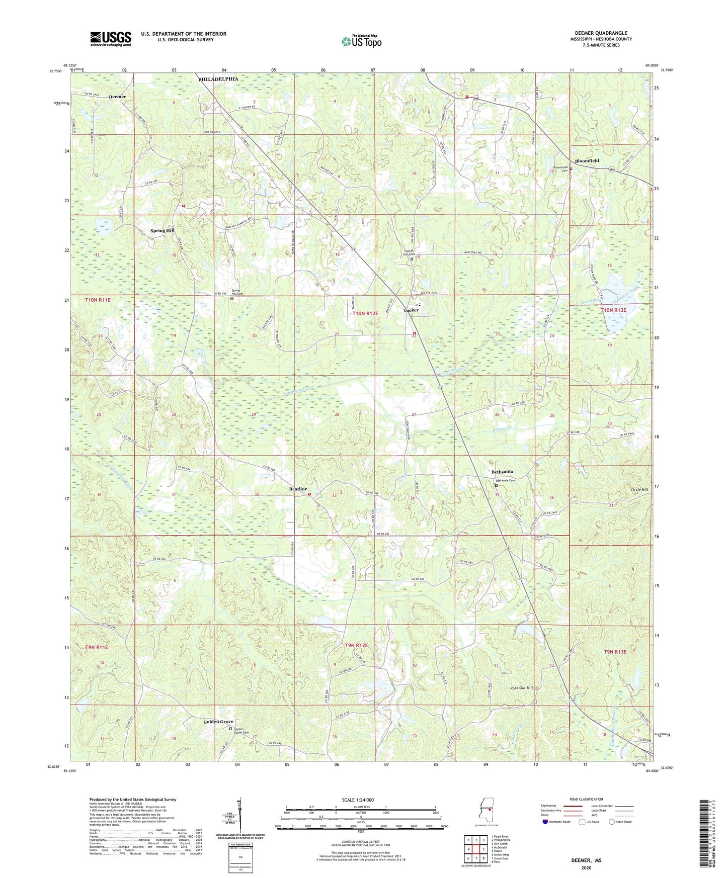
2024 topographic map quadrangle Deemer in the state of Mississippi. Scale: 1:24000. Based on the newly updated USGS 7.5' US Topo map series, this map is in the following counties: Neshoba. The map contains contour data, water features, and other items you are used to seeing on USGS maps, but also has updated roads and other features. This is the next generation of topographic maps. Printed on high-quality waterproof paper with UV fade-resistant inks.
Quads adjacent to this one:
West: McDonald
Northwest: Pearl River
North: Philadelphia
Northeast: Owl Creek
East: House
Southeast: Post
South: Union East
Southwest: Union West
This map covers the same area as the classic USGS quad with code o32089f1.
Contains the following named places: Beatline, Bethesda Cemetery, Bethsaida, Billy Creek, Blinker Creek, Bloomfield, Bloomfield Cemetery, Bruce Lattimer Lake Dam, Center Hill Cemetery, Circle Hill, Community Church, Coonshuck Canal, County Line Volunteer Fire Department Station 2, Cushtusia Canal, Cushtusia Creek, Deemer, Engine, George Posey Lake Dam, Golden Grove, Golden Grove Cemetery, Holy Rosary Indian Mission Church, J Allison Lake Dam, Jones Lake Dam, Marion Perry Lake Dam, Mount Olive Church, Neshoba County Lake, Neshoba Springs, Rock Gut Hill, Sharps, Spring Hill, Spring Hill Cemetery, Supervisor District 3, Tucker, Tucker Census Designated Place, Tucker Indian School, Tucker Volunteer Fire Department Station 1, Tucker Volunteer Fire Department Station 2, Tucker Volunteer Fire Department Station 3