MyTopo
Sellers Mississippi US Topo Map
Couldn't load pickup availability
Also explore the Sellers Forest Service Topo of this same quad for updated USFS data
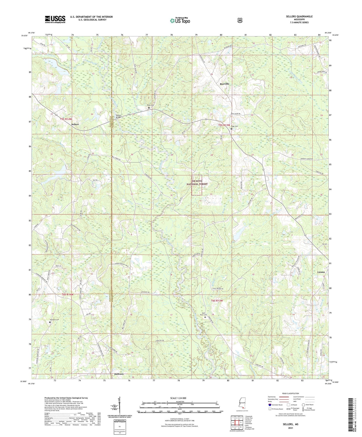
2024 topographic map quadrangle Sellers in the state of Mississippi. Scale: 1:24000. Based on the newly updated USGS 7.5' US Topo map series, this map is in the following counties: Harrison, Hancock. The map contains contour data, water features, and other items you are used to seeing on USGS maps, but also has updated roads and other features. This is the next generation of topographic maps. Printed on high-quality waterproof paper with UV fade-resistant inks.
Quads adjacent to this one:
West: Necaise
Northwest: Savannah
North: Silver Run
Northeast: McHenry
East: Wortham
Southeast: Gulfport NW
South: Dedeaux
Southwest: Kiln
This map covers the same area as the classic USGS quad with code o30089e3.
Contains the following named places: Bay Branch, Bell Creek, Bethel Memorial Church, Country Acres Summer Camp, Crane Creek, Dedeaux School, First Pentecostal Lighthouse Church, Grace Baptist Church, Lizana, Mill Creek, Mississippi No Name 43 Dam, Morning Glory Lake, Page Cemetery, Persimmon Mill Church, Post 58 Volunteer Fire Department Station 2, Riceville, Salem Scout Lake Dam, Salmen Scout Reservation, Salmon Boy Scout Camp, Scenic Trails Campground, Sellers, Sellers Bridge, Sellers School, Shaw Cemetery, Shaw Lake Dam, Standard Cemetery, Wolf Creek Church, Wolf River Cemetery