MyTopo
Merigold Mississippi US Topo Map
Couldn't load pickup availability
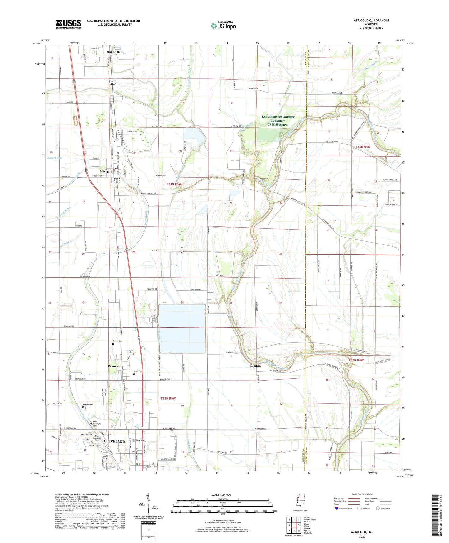
2020 topographic map quadrangle Merigold in the state of Mississippi. Scale: 1:24000. Based on the newly updated USGS 7.5' US Topo map series, this map is in the following counties: Bolivar, Sunflower. The map contains contour data, water features, and other items you are used to seeing on USGS maps, but also has updated roads and other features. This is the next generation of topographic maps. Printed on high-quality waterproof paper with UV fade-resistant inks.
Quads adjacent to this one:
West: Pace
Northwest: Shelby
North: Mound Bayou
Northeast: Baltzer
East: Drew
Southeast: Ruleville
South: Cleveland
Southwest: Skene
Contains the following named places: Beaver Bayou, Beaver Cemetery, Bethany Church, Bolivar County Fire Department District 1 Station 2 Merigold, Brown Cemetery, Cleveland Industrial Park, Davis Chapel, Delta State Golf Course, Dorr Field, Hyde Bayou, Jerusalem Church, Joseph Chapel, Lampton Chapel, Little Mound Bayou, Matthews Crossing, Merigold, Merigold Police Department, Merigold Post Office, Merigold School, Merigold Sewage Lagoon Dam, Mississippi Power and Light Pond Dam, Mound Bayou, New Cleveland Cemetery, New Morning Star Church, Old Cleveland Cemetery, Parks Chapel, Pleasant Green Church, Providence Church, Renova, Renova School, Riverside School, Rose Hill Church, Saint Marys Church, Shipmans Chapel, Smith Cemetery, Smith School, Sunflower School, Supervisor District 4, Town of Merigold, Town of Renova, Union Grove Church, White Cloud Chapel, White Zion School, Whites Chapel, Wilnot Chapel, WQAZ-FM (Cleveland), WRDC-AM (Cleveland), Zumbro, ZIP Codes: 38732, 38759