MyTopo
Shelby Mississippi US Topo Map
Couldn't load pickup availability
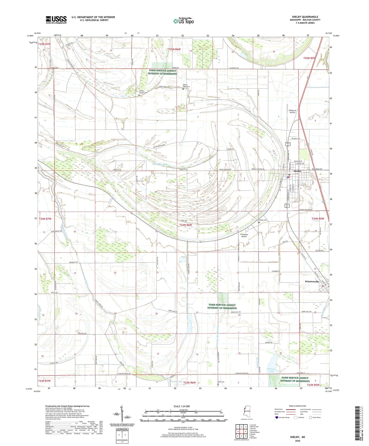
2024 topographic map quadrangle Shelby in the state of Mississippi. Scale: 1:24000. Based on the newly updated USGS 7.5' US Topo map series, this map is in the following counties: Bolivar. The map contains contour data, water features, and other items you are used to seeing on USGS maps, but also has updated roads and other features. This is the next generation of topographic maps. Printed on high-quality waterproof paper with UV fade-resistant inks.
Quads adjacent to this one:
West: Gunnison
Northwest: Laconia
North: Round Lake
Northeast: Duncan
East: Mound Bayou
Southeast: Merigold
South: Pace
Southwest: Beulah
This map covers the same area as the classic USGS quad with code o33090h7.
Contains the following named places: Allendales Lake Dam, Bellamy Chapel, Broad Street High School, Brown Temple, California Brake, Christmas Airport, City of Shelby, Ditch Number Five, Ditch Number Four, Ditch Number One, Ditch Number Six, Ditch Number Three, Hall Cemetery, Holmes Lake, Holmes Lake Cut-Off, Macedonia Church, Manocknut Plantation, Mound Bayou Recreation Lake Dam, Mount Olive Church, New Hope Church, New Mount Zion Church, New Prospect Church, Old Mount Olive Church, Peters Rock Cemetery, Pleasant Green Church, Porter Lake, Raineys Lake, Saint James Church, Shelby, Shelby Air Service, Shelby Cemetery, Shelby City Police Department, Shelby Community Hospital, Shelby Elementary School, Shelby Post Office, Shelby Volunteer Fire Department Station 7, Sunnyside Church, Town of Winstonville, Turkey Pen Bayou, Turners Chapel, Turners Chapel Cemetery, Union Hill Church, Upper Bogue, Watson Temple, Winstonville, Winstonville Volunteer Fire Department, ZIP Codes: 38774, 38781