MyTopo
Midnight NW Mississippi US Topo Map
Couldn't load pickup availability
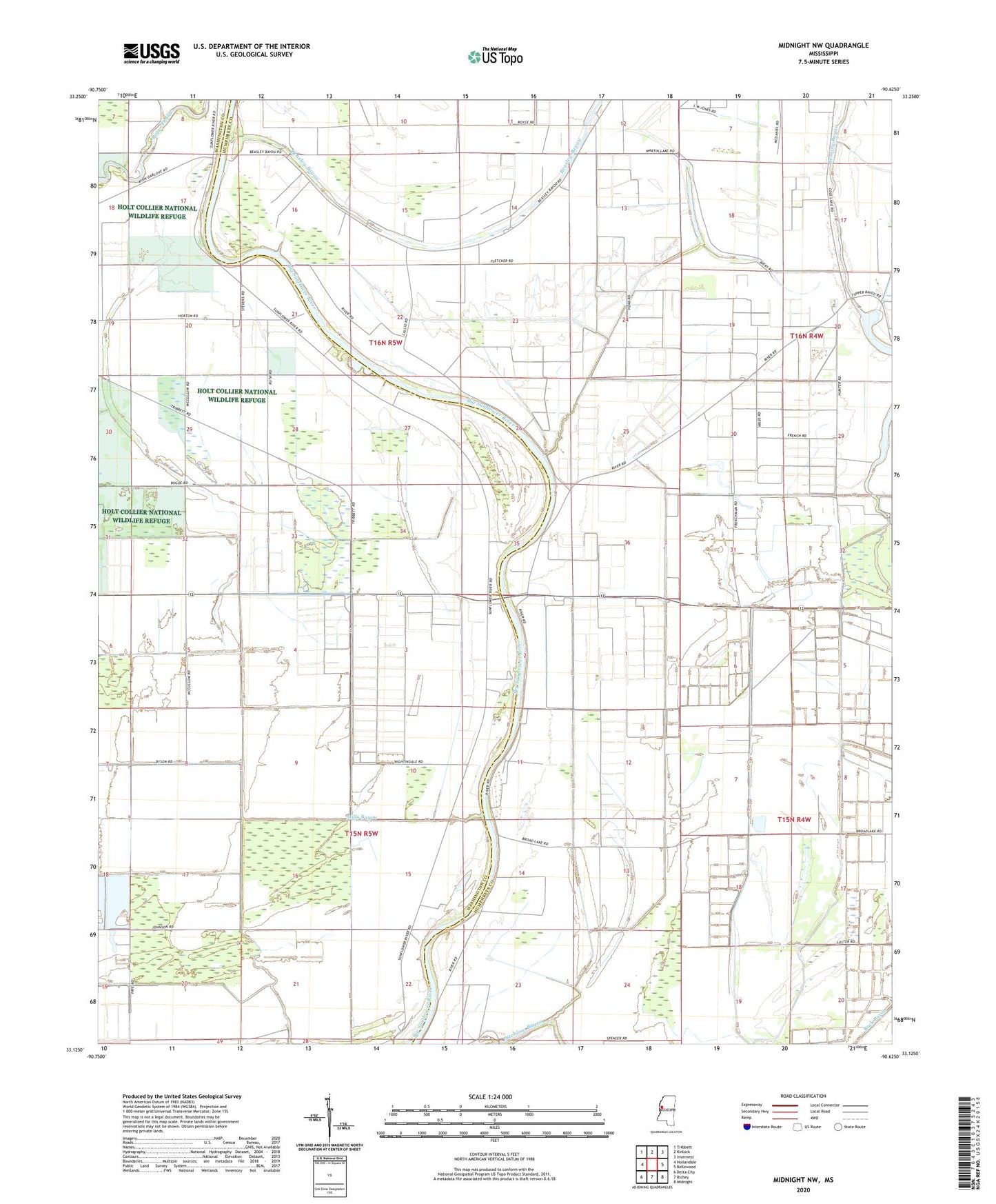
2020 topographic map quadrangle Midnight NW in the state of Mississippi. Scale: 1:24000. Based on the newly updated USGS 7.5' US Topo map series, this map is in the following counties: Humphreys, Washington. The map contains contour data, water features, and other items you are used to seeing on USGS maps, but also has updated roads and other features. This is the next generation of topographic maps. Printed on high-quality waterproof paper with UV fade-resistant inks.
Quads adjacent to this one:
West: Hollandale
Northwest: Tribbett
North: Kinlock
Northeast: Inverness
East: Bellewood
Southeast: Midnight
South: Richey
Southwest: Delta City
Contains the following named places: Beasley Bayou, Booth Lake Dam, Broad Lake, Central Church, Cochran Brothers Lake Dam, Cold Lake Church, Dave Jones Catfish Ponds Dam, Grant Lake Dam, H D Tharp Lake Dam, H D Tharp Pond Dam, Herron Brothers Lake Dam, Lock Church, Martin Hawkins Pond Dam, Martin Lake, Mills Bayou, New Foundation Church, O J Turner Third Lake Dam, Pickell Lake Dam, R B Hoke Lake Dam, R L Hoke Lake Dam, Rising Star Church, Slater Ferry, Sunflower Chapel, Supervisor District 2, Tisdale Lake Dam, Watson School