MyTopo
Delta City Mississippi US Topo Map
Couldn't load pickup availability
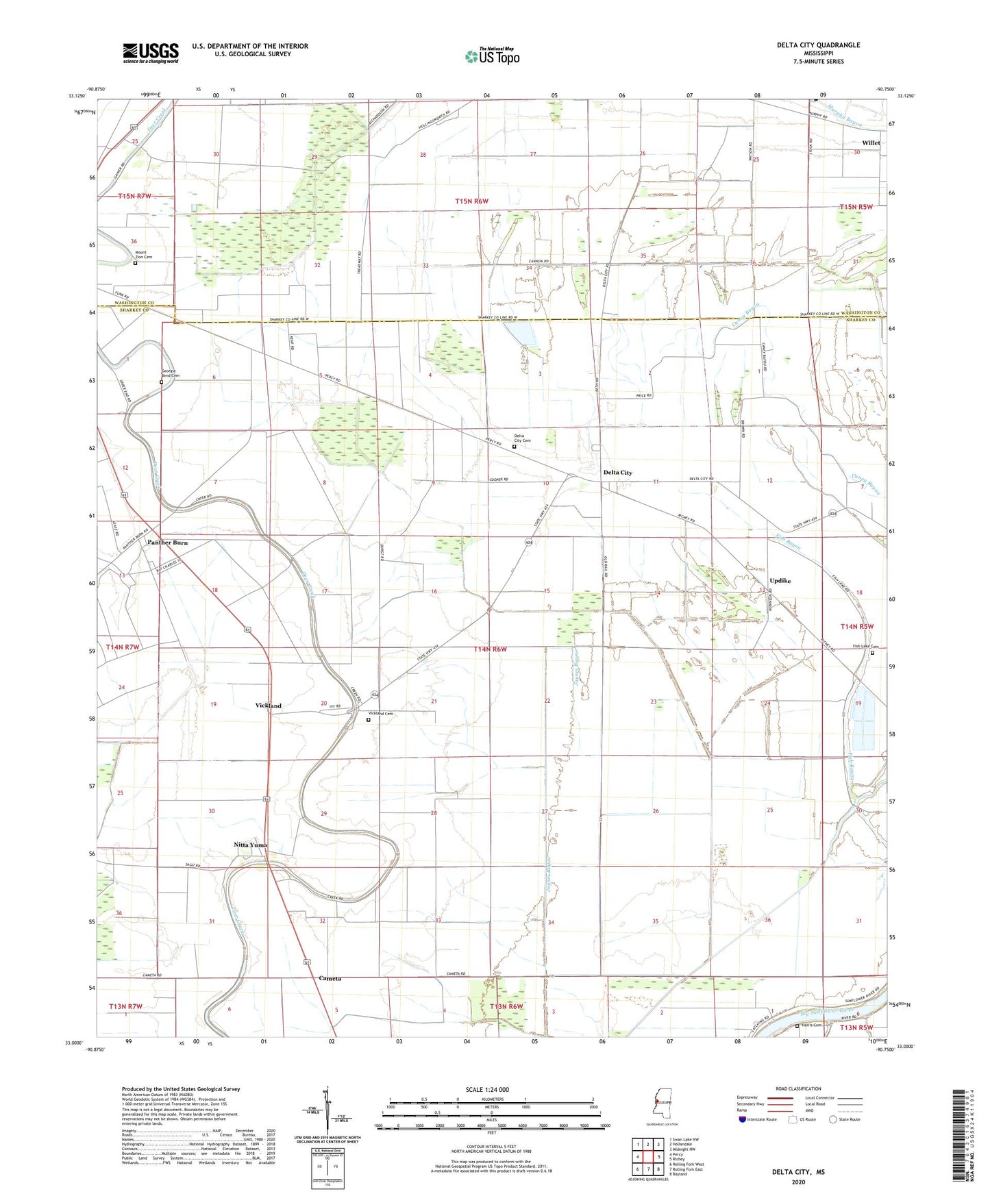
2024 topographic map quadrangle Delta City in the state of Mississippi. Scale: 1:24000. Based on the newly updated USGS 7.5' US Topo map series, this map is in the following counties: Sharkey, Washington. The map contains contour data, water features, and other items you are used to seeing on USGS maps, but also has updated roads and other features. This is the next generation of topographic maps. Printed on high-quality waterproof paper with UV fade-resistant inks.
Quads adjacent to this one:
West: Percy
Northwest: Swan Lake NW
North: Hollandale
Northeast: Midnight NW
East: Richey
Southeast: Bayland
South: Rolling Fork East
Southwest: Rolling Fork West
This map covers the same area as the classic USGS quad with code o33090a7.
Contains the following named places: A B Williams Catfish Ponds Dam, Cameta, Delta City, Delta City Cemetery, Delta City Census Designated Place, Delta City Post Office, Eastern Star Church, Fish Lake, Fish Lake Cemetery, Georgia Bend Cemetery, Harris Cemetery, Hebron Church, Mount Zion Cemetery, Nitta Yuma, Nitta Yuma Census Designated Place, Nitta Yuma Post Office, Panther Burn, Panther Burn Census Designated Place, Pleasant Valley Church, Saint Paul Church, Shraderville, Supervisor District 5, Sweet Home Church, Updike, Vickland, Vickland Cemetery, Willet, ZIP Codes: 38765, 39061