MyTopo
Zetus Mississippi US Topo Map
Couldn't load pickup availability
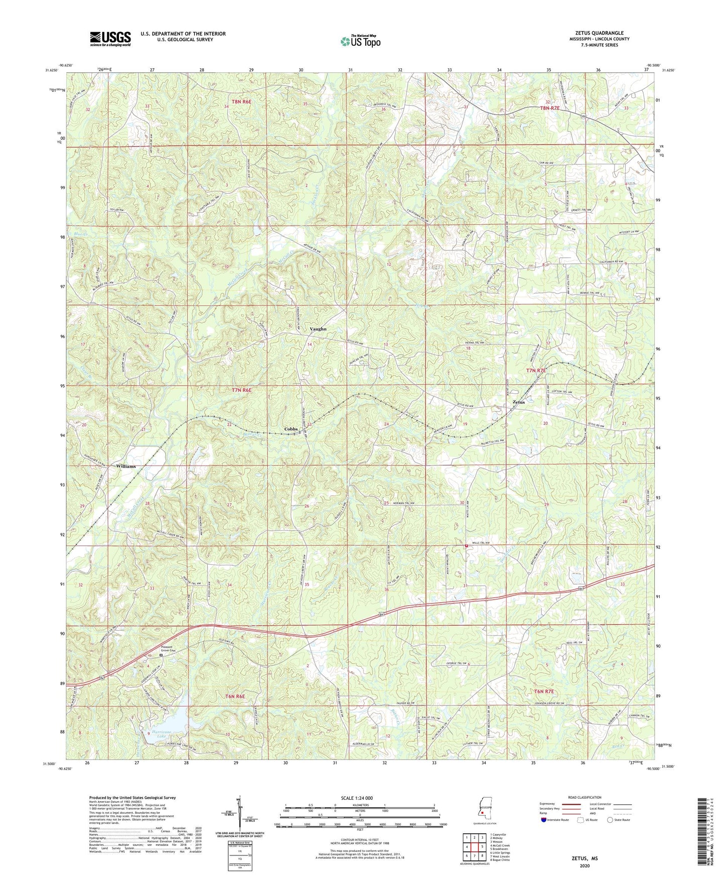
2024 topographic map quadrangle Zetus in the state of Mississippi. Scale: 1:24000. Based on the newly updated USGS 7.5' US Topo map series, this map is in the following counties: Lincoln. The map contains contour data, water features, and other items you are used to seeing on USGS maps, but also has updated roads and other features. This is the next generation of topographic maps. Printed on high-quality waterproof paper with UV fade-resistant inks.
Quads adjacent to this one:
West: McCall Creek
Northwest: Caseyville
North: Midway
Northeast: Wesson
East: Brookhaven
Southeast: Bogue Chitto
South: West Lincoln
Southwest: Little Springs
This map covers the same area as the classic USGS quad with code o31090e5.
Contains the following named places: Antioch Church, Beaver Creek, Bethel Church, Blue Creek, Brookhaven Oil Field, Clear Branch, Cobbs, Crump Church, Ebenezer Church, Edwards School, Foster Lake Dam, Friendship Church, Greater Mount Olive Church, Hawkins Chapel, Hog Branch, Hurricane Lake, Hurricane Lake Dam, Jackson Creek, Johnson Grove Church, Lincoln Lookout Tower, McCalls Creek Precinct, Mount Zion Church, New Prospect Church, New Salem Church, Ollie School, Pleasant Grove Baptist Church, Pleasant Grove Cemetery, Progress School, Shaws Creek, Siloam Church, Supervisor District 5, Vaughn, Williams, Zetus, Zetus Volunteer Fire Department Station 1