
MyTopo
Monticello Mississippi US Topo Map
Couldn't load pickup availability
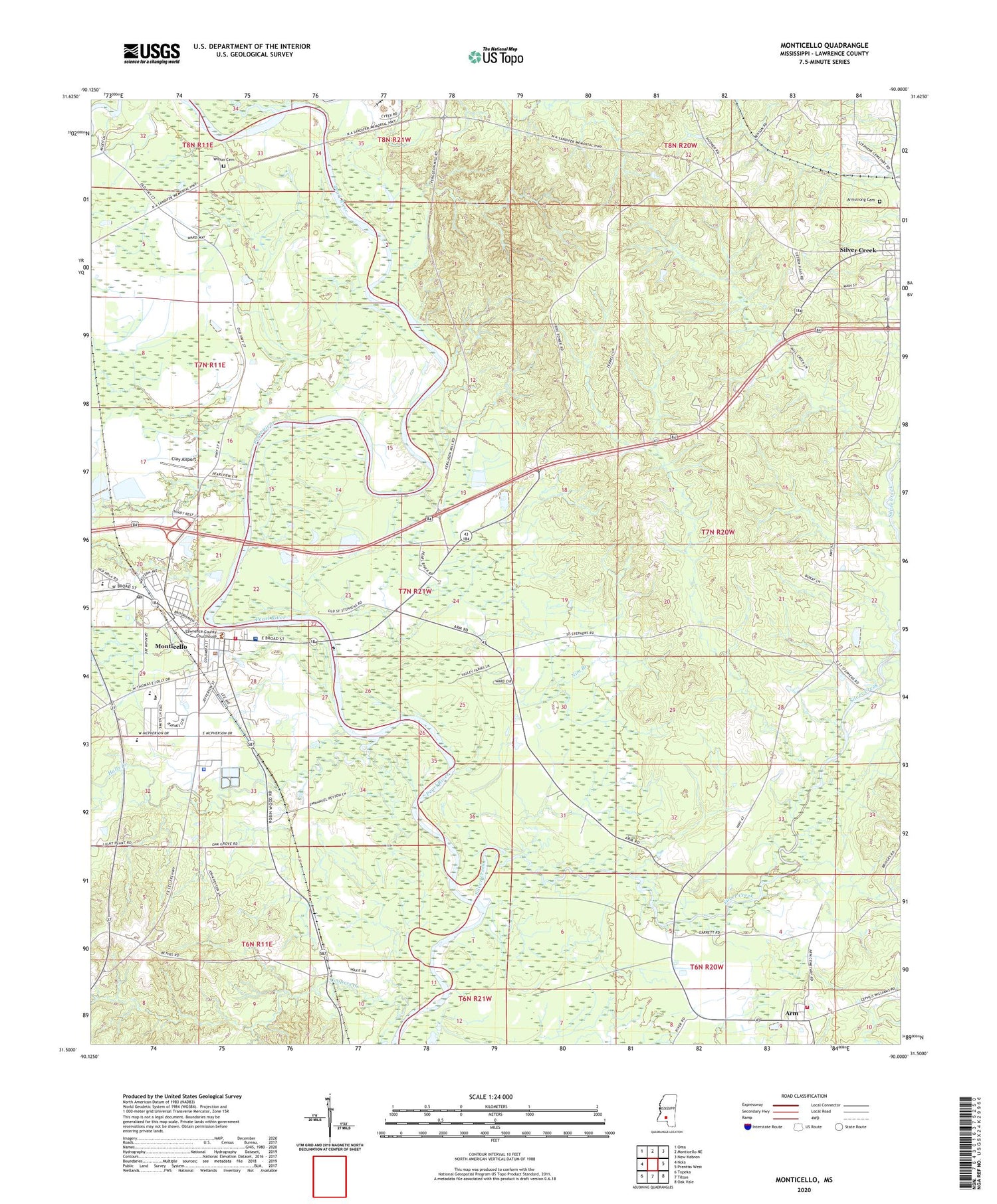
2024 topographic map quadrangle Monticello in the state of Mississippi. Scale: 1:24000. Based on the newly updated USGS 7.5' US Topo map series, this map is in the following counties: Lawrence. The map contains contour data, water features, and other items you are used to seeing on USGS maps, but also has updated roads and other features. This is the next generation of topographic maps. Printed on high-quality waterproof paper with UV fade-resistant inks.
Quads adjacent to this one:
West: Nola
Northwest: Oma
North: Monticello NE
Northeast: New Hebron
East: Prentiss West
Southeast: Oak Vale
South: Tilton
Southwest: Topeka
This map covers the same area as the classic USGS quad with code o31090e1.
Contains the following named places: Arm, Arm Volunteer Fire Department, Armstrong Cemetery, Bethel Church, Canaan Church, Church of Christ, Church of God, Clay Airport, Commons Store, Coopers Creek, Fair River, First Assembly of God Church, Fortenberry Pond Dam, Friendship Church, Halls Creek, Hardscrabble, Lawrence County, Lawrence County Hospital, Lawrence County Sheriff's Office, McCullough Junior High School, Monticello, Monticello Baptist Church, Monticello Elementary School, Monticello Fire Department, Monticello First Baptist Church, Monticello High School, Monticello Police Department, Monticello Post Office, Monticello United Methodist Church, Nim Branch, Oak Grove Missionary Baptist Church, Old Silver Creek Church, Pearl River Valley Church, Pin Oak Church, Pretty Branch, Riverside Baptist Church, Rocky Branch Baptist Church, Saint Paul Church, Saint Regis Paper Holding Reservoir, Sheppards Store, Silver Creek, Southgate Baptist Church, Supervisor District 5, Town of Monticello, Town of Silver Creek, Wilson Cemetery, ZIP Code: 39663


