MyTopo
Moon Lake Mississippi US Topo Map
Couldn't load pickup availability
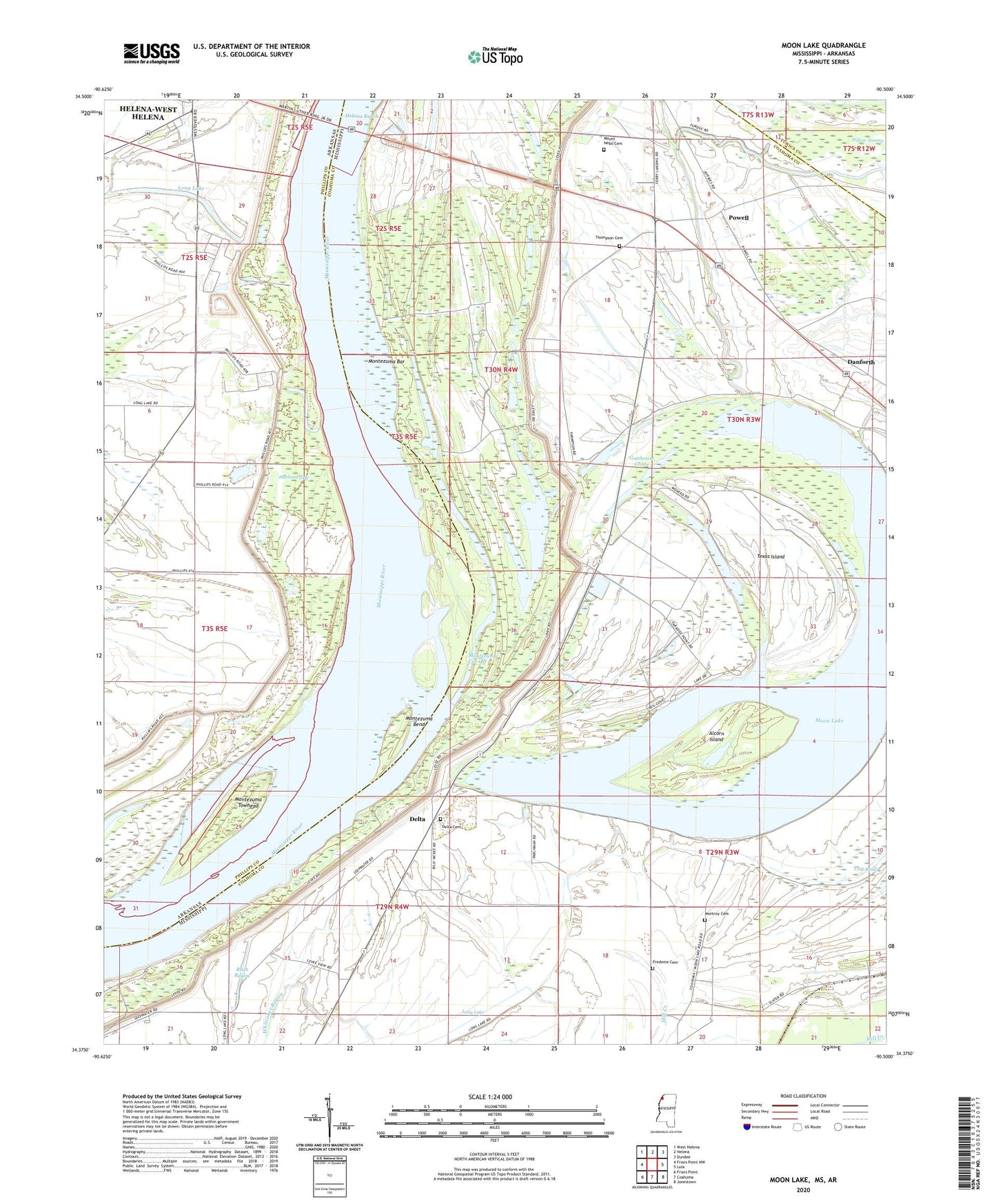
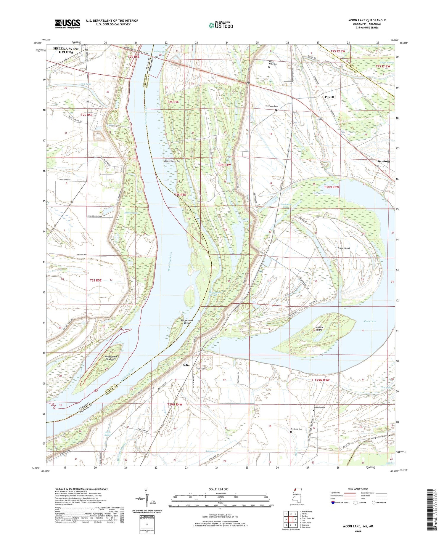
2020 topographic map quadrangle Moon Lake in the states of Mississippi, Arkansas. Scale: 1:24000. Based on the newly updated USGS 7.5' US Topo map series, this map is in the following counties: Coahoma, Phillips, Tunica. The map contains contour data, water features, and other items you are used to seeing on USGS maps, but also has updated roads and other features. This is the next generation of topographic maps. Printed on high-quality waterproof paper with UV fade-resistant inks.
Quads adjacent to this one:
West: Friars Point NW
Northwest: West Helena
North: Helena
Northeast: Dundee
East: Lula
Southeast: Jonestown
South: Coahoma
Southwest: Friars Point
Contains the following named places: Alcorn Island, Bethlehem Church, Bethlehem School, Carr Brake, Chute Lake, Danforth, Delta, Delta Cemetery, Delta School, Delta-Friars Point Revetment, Fitzhugh Landing, Fredonia Cemetery, Fredonia Church, Gerald, Gunhouse Chute, Helena Casting Field Landing, Helena Crossing Elementary School, Hubbard Lake, Jerusalem Church, Long Lake, Montezuma Bar, Montezuma Bend, Montezuma Cut-Off, Montezuma Towhead, Montezuma Towhead Dikes, Montroy Cemetery, Moon Lake, Mount Nebo Cemetery, Mount Nebo Church, New Morning Star Church, Phillips Bayou, Powell, Rowen Bayou, Rush Bayou, Saint Luke Church, Saint Luke School, Saint Marks Church, Silver Cloud Church, Stokes, Stokes Landing, Summerville Chapel, Supervisor District 1, Texas Island, Thompson Cemetery, Thompson Chapel, Williamson Landing, Willow Swamp, Wilson Chapel