MyTopo
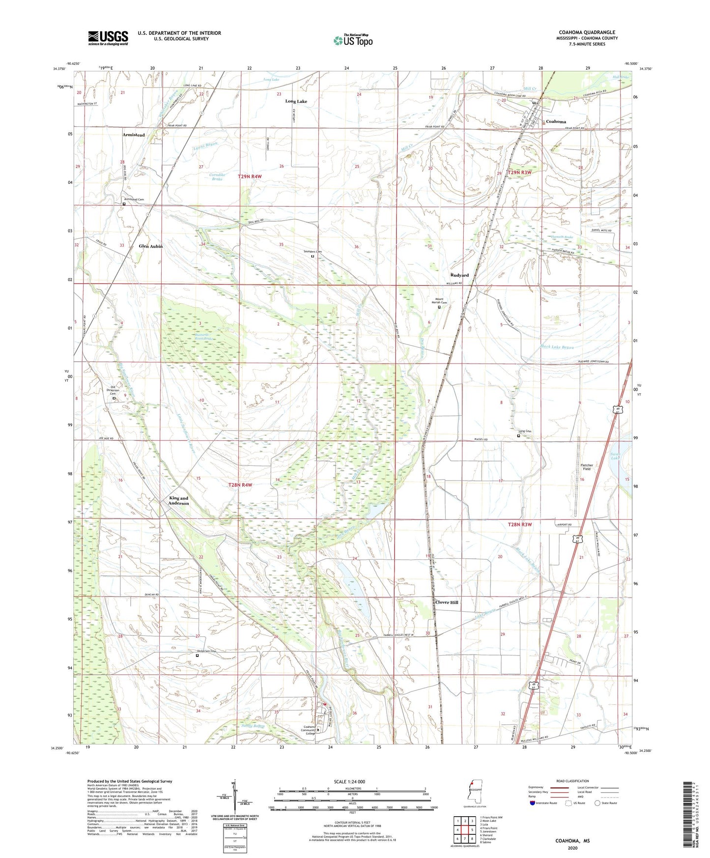
Coahoma Mississippi US Topo Map
Couldn't load pickup availability
2024 topographic map quadrangle Coahoma in the state of Mississippi. Scale: 1:24000. Based on the newly updated USGS 7.5' US Topo map series, this map is in the following counties: Coahoma. The map contains contour data, water features, and other items you are used to seeing on USGS maps, but also has updated roads and other features. This is the next generation of topographic maps. Printed on high-quality waterproof paper with UV fade-resistant inks.
Quads adjacent to this one:
West: Friars Point
Northwest: Friars Point NW
North: Moon Lake
Northeast: Lula
East: Jonestown
Southeast: Sabino
South: Clarksdale
Southwest: Sherard
This map covers the same area as the classic USGS quad with code o34090c5.
Contains the following named places: Armistead, Armistead Cemetery, Armistead Church, Barkley Bayou, Black Lake Bayou, Buzzards Roost Brake, Clover Hill, Coahoma, Coahoma Community College Fire Department, Coahoma County Agricultural High School, Coahoma Junior College, Coahoma Post Office, Corndike Brake, Dickerson Cemetery, Dry Bayou, Fant Church, Fant School, Fleets Church, Fletcher Field, Glen Aubin, Grassy Lake, Hamson Brake, Heavenly Rest Memorial Park, Hull Plantation, Irvin Plantation, J T Farguson Pond Dam, King and Anderson, King and Anderson Lake Dam, King and Anderson Ranch, Kings Chapel, Kings School, Long Cemetery, Long Lake, Lyons Bayou, Mackie Lake, Maddox Plantation, Mill Creek, Mount Mariah Cemetery, Mount Moriah Church, Mount Zion Church, Oakhurst Plantation, Old Dickerson Cemetery, Pilgrim Rest Church, Prairie Plantation, Reese Church, Rudyard, Saint Clair Church, Saint Johns Church, Saint Johns School, Saunders Cemetery, Saunders Chapel, Shady Grove Church, Sheriff Ridge School, Swan Lake School, Town of Coahoma, Whittaker Bayou, ZIP Codes: 38617, 38631