MyTopo
Waldrup Mississippi US Topo Map
Couldn't load pickup availability
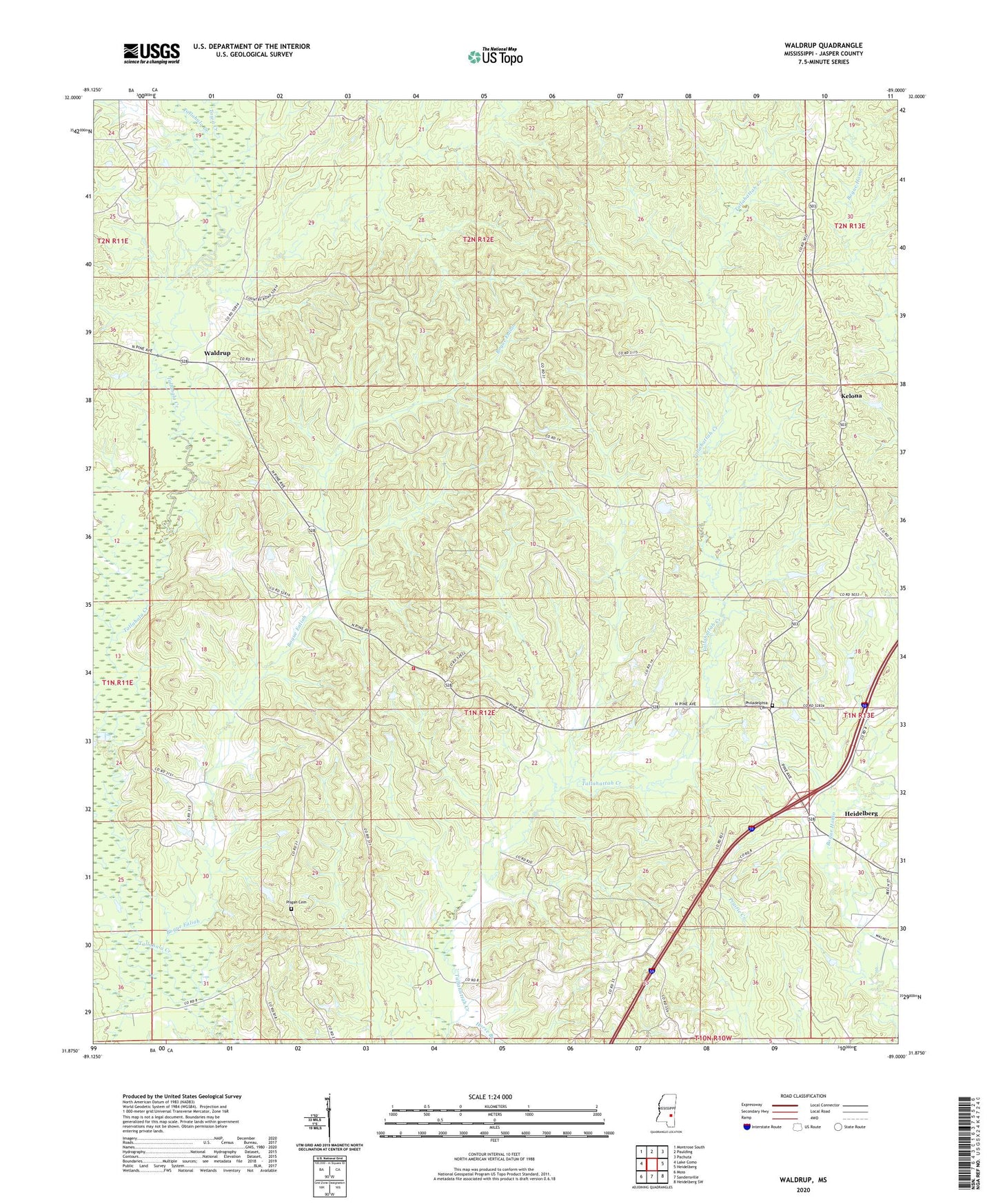
2024 topographic map quadrangle Waldrup in the state of Mississippi. Scale: 1:24000. Based on the newly updated USGS 7.5' US Topo map series, this map is in the following counties: Jasper. The map contains contour data, water features, and other items you are used to seeing on USGS maps, but also has updated roads and other features. This is the next generation of topographic maps. Printed on high-quality waterproof paper with UV fade-resistant inks.
Quads adjacent to this one:
West: Lake Como
Northwest: Montrose South
North: Paulding
Northeast: Pachuta
East: Heidelberg
Southeast: Heidelberg SW
South: Sandersville
Southwest: Moss
This map covers the same area as the classic USGS quad with code o31089h1.
Contains the following named places: Bailey Oil Pool, Bogue Ealiah, Brevet, Burgin Lake Dam, Claiborne, Cotton Valley Oil Pool, Counterline Church, Ebenezer Church, Eutaw Oil Pool, Eutaw-Masonite Oil Pool, Fairview Church, Horse Branch, Kelona, Kelona Church, Lower Hosston Oil Pool, Middle Hosston Oil Pool, Nuakfuppa Creek, Oak Bowery, Oak Bowery Volunteer Fire Department, Oakbowery Church, Old Ebenezer Church, Philadelphia Cemetery, Philadelphia Church, Pisgah Cemetery, Pisgah Church, Rowell Lake Dam, Supervisor District 5, Tennessee Gas Lake Dam, Town Creek, Union Church, Waldrup, WEEZ-FM (Heidelberg), West Heidelberg Oil Field