MyTopo
Ethel SE Mississippi US Topo Map
Couldn't load pickup availability
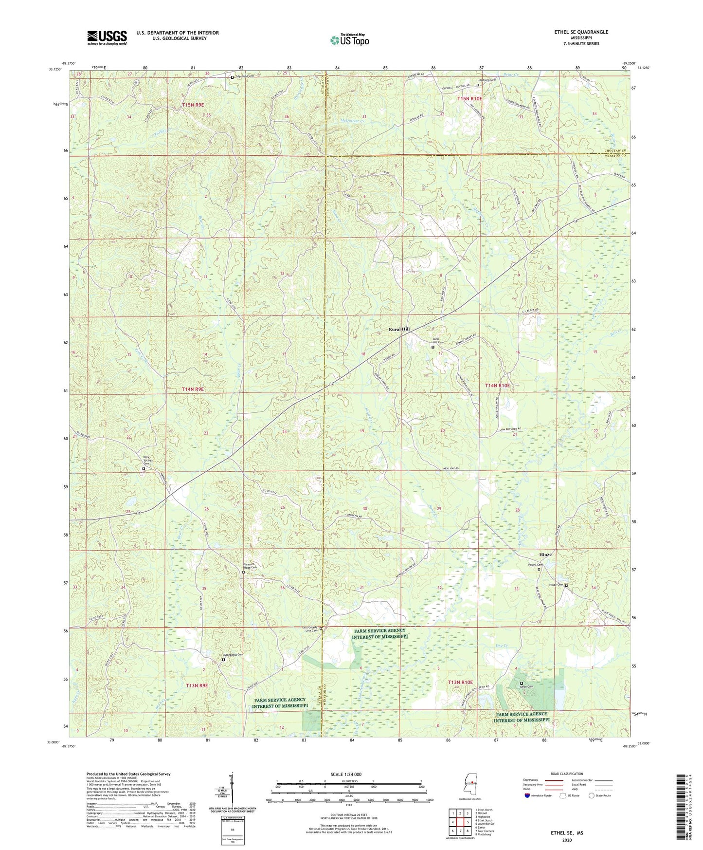
2024 topographic map quadrangle Ethel SE in the state of Mississippi. Scale: 1:24000. Based on the newly updated USGS 7.5' US Topo map series, this map is in the following counties: Winston, Attala, Choctaw. The map contains contour data, water features, and other items you are used to seeing on USGS maps, but also has updated roads and other features. This is the next generation of topographic maps. Printed on high-quality waterproof paper with UV fade-resistant inks.
Quads adjacent to this one:
West: Ethel South
Northwest: Ethel North
North: McCool
Northeast: Highpoint
East: Louisville SW
Southeast: Plattsburg
South: Four Corners
Southwest: Zama
This map covers the same area as the classic USGS quad with code o33089a3.
Contains the following named places: Ball Creek, Briar Creek, Commodore Post Office, Doty Springs, Doty Springs Baptist Church, Doty Springs Cemetery, Doty Springs School, Dry Creek, East County Line Cemetery, East County Line Church, East Macedonia, East Macedonia Methodist Church, Edgefield, Edgefield Baptist Church, Edgefield Cemetery, Edgefield School, Edwards Mill, Glendale, Glendale School, Hinze, Hinze Cemetery, Hinze Church, Hopewell Cemetery, Hopewell Church, Leachs Mill, Little Creek, Lobutcha, Macedonia Cemetery, McCool Lookout Tower, McQuirter Creek, Nebo Cemetery, Pleasant Ridge Cemetery, Pleasant Ridge Primitive Baptist Church, Rural Hill, Rural Hill Cemetery, Rural Hill Methodist Church, Saint Pauls Church, Sand Creek, Tom Fork, Vowell Cemetery