MyTopo
Noxapater Mississippi US Topo Map
Couldn't load pickup availability
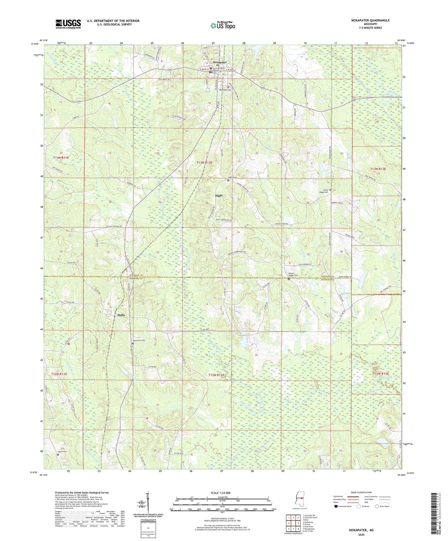
2024 topographic map quadrangle Noxapater in the state of Mississippi. Scale: 1:24000. Based on the newly updated USGS 7.5' US Topo map series, this map is in the following counties: Winston, Neshoba. The map contains contour data, water features, and other items you are used to seeing on USGS maps, but also has updated roads and other features. This is the next generation of topographic maps. Printed on high-quality waterproof paper with UV fade-resistant inks.
Quads adjacent to this one:
West: Plattsburg
Northwest: Louisville SW
North: Louisville South
Northeast: Boon
East: Vernon
Southeast: Owl Creek
South: Philadelphia
Southwest: Pearl River
This map covers the same area as the classic USGS quad with code o32089h1.
Contains the following named places: Argo, Bell Branch, Bogue Chitto, First Pentecostal Church, Hight, Hight Cemetery, Hight Church, Jesus Name Church, Joe C Reese Lake Dam, Joel Creek, Kingdom Hall of Jehovahs Witnesses, Methodist Cemetery, Mount Ary Cemetery, Mount Ary Church, Mount Carmel Baptist Cemetery, Mount Pisgah Cemetery, Mount Pisgah Church, Mount Vernon Church, Nanih Waiya Creek, Narrow Way Church, Noxapater, Noxapater Creek, Noxapater Methodist Church, Noxapater Police Department, Noxapater Post Office, Noxapater School, Noxapater Volunteer Fire Department, Odell Barrier Dam, O'Neal Jackson Lake Dam, R Baskin Lake Dam, Salem Cemetery, Salem Church, Stallo, Stallo Volunteer Fire Department Station 1 Headquarters, Stallo Volunteer Fire Department Station 2, T J Barrier Lake Dam, Town of Noxapater, Union Ridge Baptist Church, Union Ridge Cemetery, Watkins Lake Dam, ZIP Code: 39346