MyTopo
Pleasant Ridge Mississippi US Topo Map
Couldn't load pickup availability
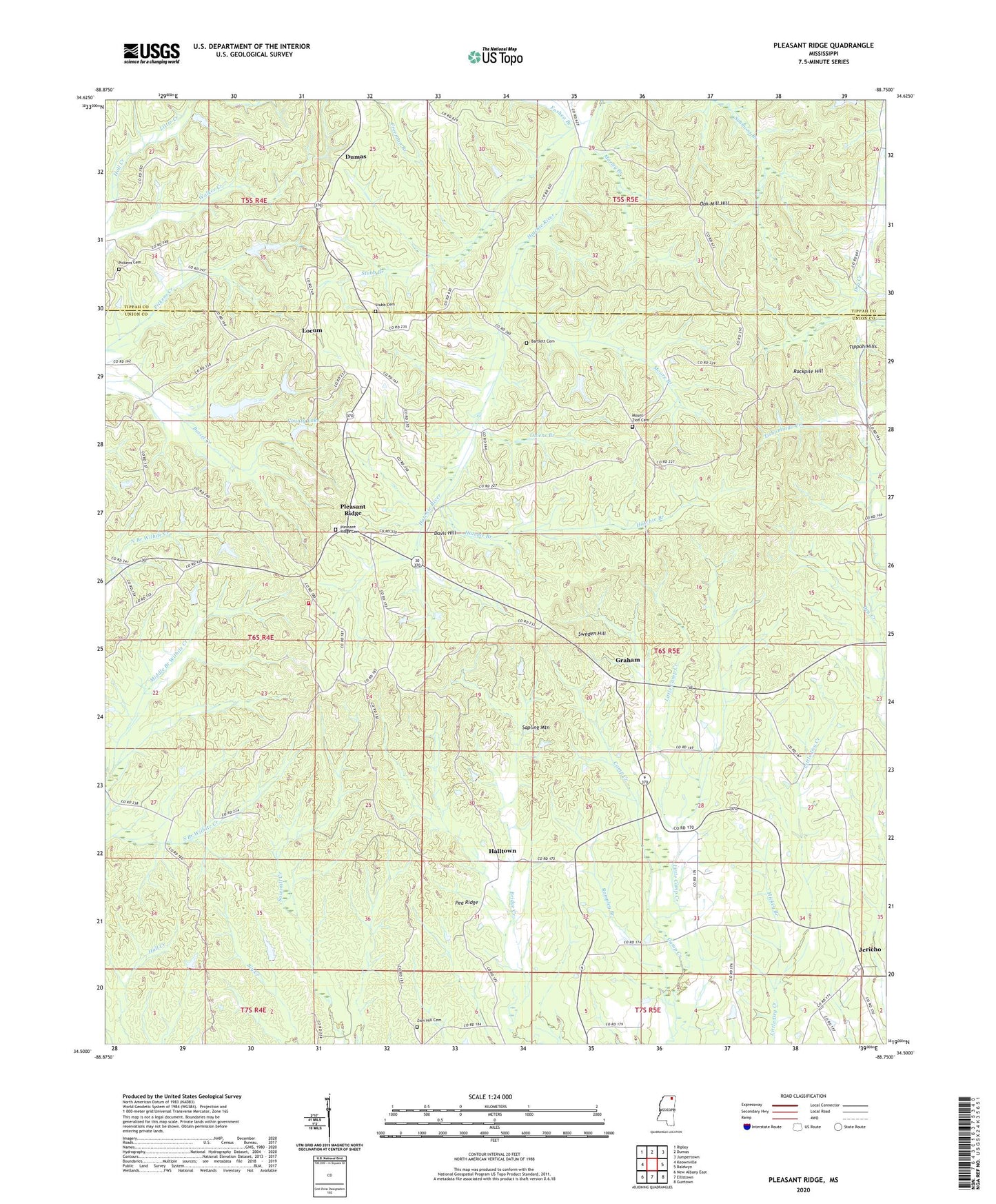
2020 topographic map quadrangle Pleasant Ridge in the state of Mississippi. Scale: 1:24000. Based on the newly updated USGS 7.5' US Topo map series, this map is in the following counties: Union, Tippah. The map contains contour data, water features, and other items you are used to seeing on USGS maps, but also has updated roads and other features. This is the next generation of topographic maps. Printed on high-quality waterproof paper with UV fade-resistant inks.
Quads adjacent to this one:
West: Keownville
Northwest: Ripley
North: Dumas
Northeast: Jumpertown
East: Baldwyn
Southeast: Guntown
South: Ellistown
Southwest: New Albany East
Contains the following named places: Bartlett Cemetery, Caney Branch, Chinaberry Church, Chinaberry School, County Lake, Davis Hill, El Bethel Church, Foshea Branch, Freeman Branch, Graham, Halltown, Hatchie Branch, Hickey Branch, Jericho, Jericho Baptist Church, Lenox, Little Camp Creek, Locum, Moore Branch, Mount Zion Cemetery, Mount Zion Church, Murley Branch, Northeast Union Fire Department Station 1, Oak Mill Hill, Owen, Owens Branch, Pea Ridge, Pickens Cemetery, Pleasant Ridge, Pleasant Ridge Baptist Church, Pleasant Ridge Cemetery, Rampley Branch, Rockpile Hill, Rockwell, Sapling Mountain, Stubb Branch, Stubb Cemetery, Supervisor District 5, Sweden Hill, Union County Lake Dam, Zion Hill Cemetery, Zion Hill Church, ZIP Code: 38625