MyTopo
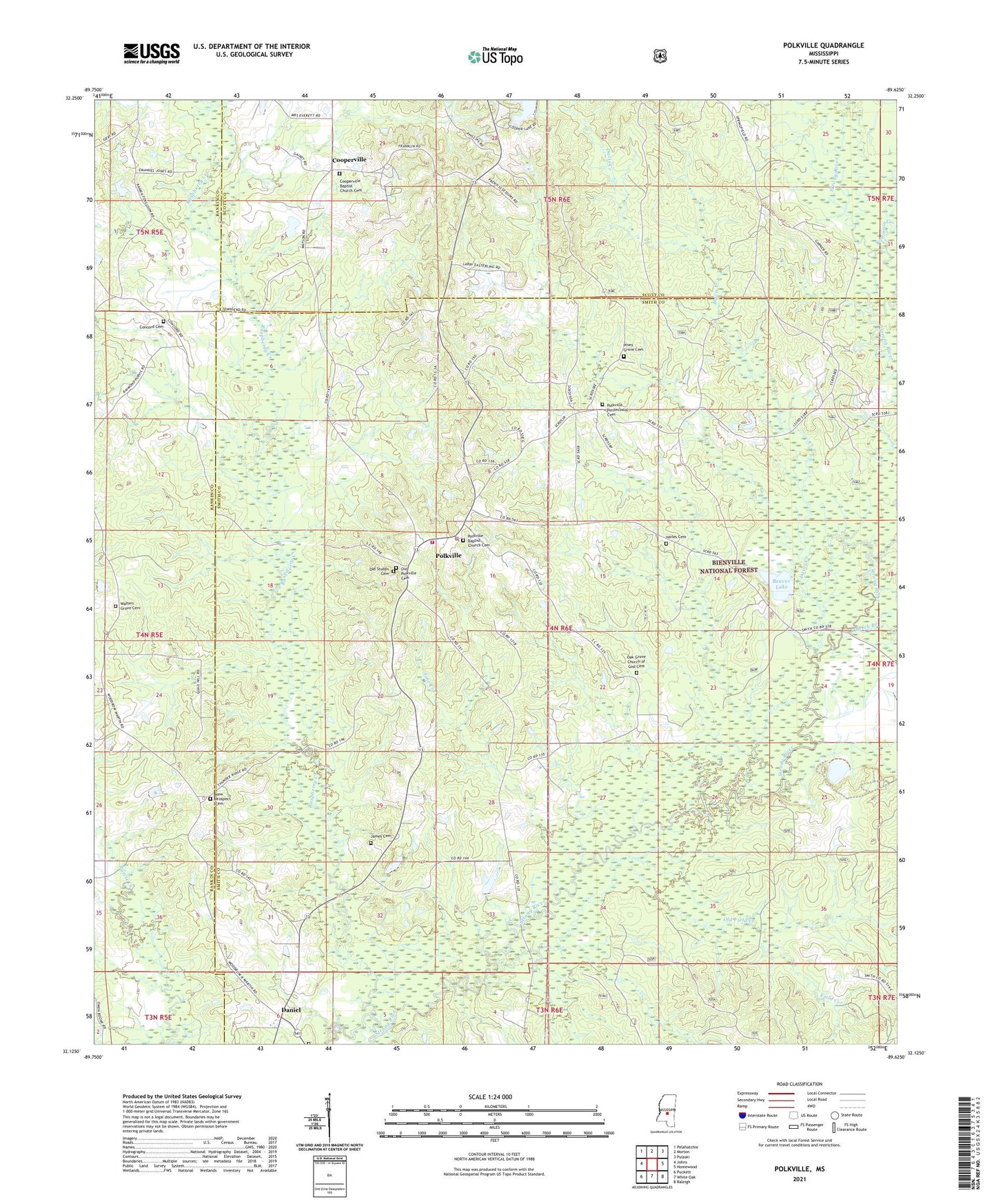
Polkville Mississippi US Topo Map
Couldn't load pickup availability
Also explore the Polkville Forest Service Topo of this same quad for updated USFS data
2024 topographic map quadrangle Polkville in the state of Mississippi. Scale: 1:24000. Based on the newly updated USGS 7.5' US Topo map series, this map is in the following counties: Smith, Scott, Rankin. The map contains contour data, water features, and other items you are used to seeing on USGS maps, but also has updated roads and other features. This is the next generation of topographic maps. Printed on high-quality waterproof paper with UV fade-resistant inks.
Quads adjacent to this one:
West: Johns
Northwest: Pelahatchie
North: Morton
Northeast: Pulaski
East: Homewood
Southeast: Raleigh
South: White Oak
Southwest: Puckett
This map covers the same area as the classic USGS quad with code o32089b6.
Contains the following named places: Beaver Lake, Beech Branch, Bethel Church, Concord Cemetery, Concord Church, Cooperville, Cooperville Baptist Church, Daniel, Davis Creek, Field Creek, Hailes Cemetery, Herbert Cooper Pond Dam, Homestead Church, Hughes Lake Dam, James Cemetery, Line Creek, New Prospect Cemetery, New Prospect Church, Oak Grove Church, Oak Grove Church of God Cemetery, Old Field Creek, Old Polkville Cemetery, Piney Grove, Piney Grove Church, Polkville, Polkville Attendance Center, Polkville Church, Polkville First Baptist Church, Polkville Pentecostal Cemetery, Raspberry Creek, Robinson Creek, Rock Bluff Cemetery, S Cooper Lake Dam, Stubb School, Town of Polkville, Walters Grove Cemetery, Waters Grove Church, Zion Church