MyTopo
Homewood Mississippi US Topo Map
Couldn't load pickup availability
Also explore the Homewood Forest Service Topo of this same quad for updated USFS data
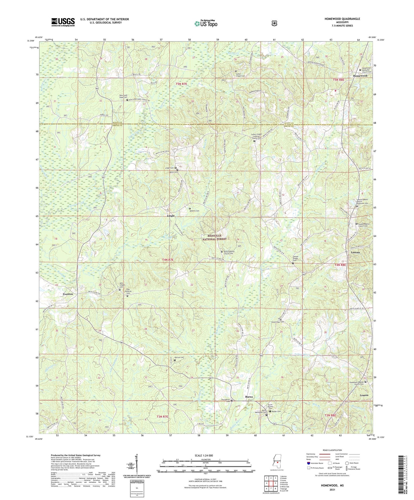
2024 topographic map quadrangle Homewood in the state of Mississippi. Scale: 1:24000. Based on the newly updated USGS 7.5' US Topo map series, this map is in the following counties: Smith, Scott. The map contains contour data, water features, and other items you are used to seeing on USGS maps, but also has updated roads and other features. This is the next generation of topographic maps. Printed on high-quality waterproof paper with UV fade-resistant inks.
Quads adjacent to this one:
West: Polkville
Northwest: Morton
North: Pulaski
Northeast: Forest
East: Pineville
Southeast: Louin SW
South: Raleigh
Southwest: White Oak
This map covers the same area as the classic USGS quad with code o32089b5.
Contains the following named places: Barber Cemetery, Barber Creek, Bethel Baptist Church Cemetery, Bethel Church, Black Cemetery, Burns, Burns Baptist Cemetery, Burns Methodist Cemetery, Burns Pit, Burns School, Caney Creek, Derrick Cemetery, E Y Mangum Lake Dam, Ellen Tadlock Pond Dam, Evangelist Temple Mission, Gasque Chapel, Gasque Chapel Cemetery, Good Hope Cemetery, Good Hope Church, Goodwater Baptist Church Cemetery, Goodwater Church, Homewood, Homewood Volunteer Fire Department, Lemon, Lingle, Lingle Cemetery, Lorena, Lorena Baptist Church Cemetery, Lorena Baptist Church Extension Cemetery, Lorena Church, Luther Chapel, Luther Chapel Cemetery, Luther Chapel Lutheran Church Cemetery, New Chapel Cemetery, New Good Hope Cemetery, New Good Hope Church, Pitt Branch, Providence Cemetery, Roberts Cemetery, Spinola School, Trenton, Wallace Epting Lake Dam, Wicker, Zion Lutheran Cemetery, ZIP Code: 39152