MyTopo
Puckett NW Mississippi US Topo Map
Couldn't load pickup availability
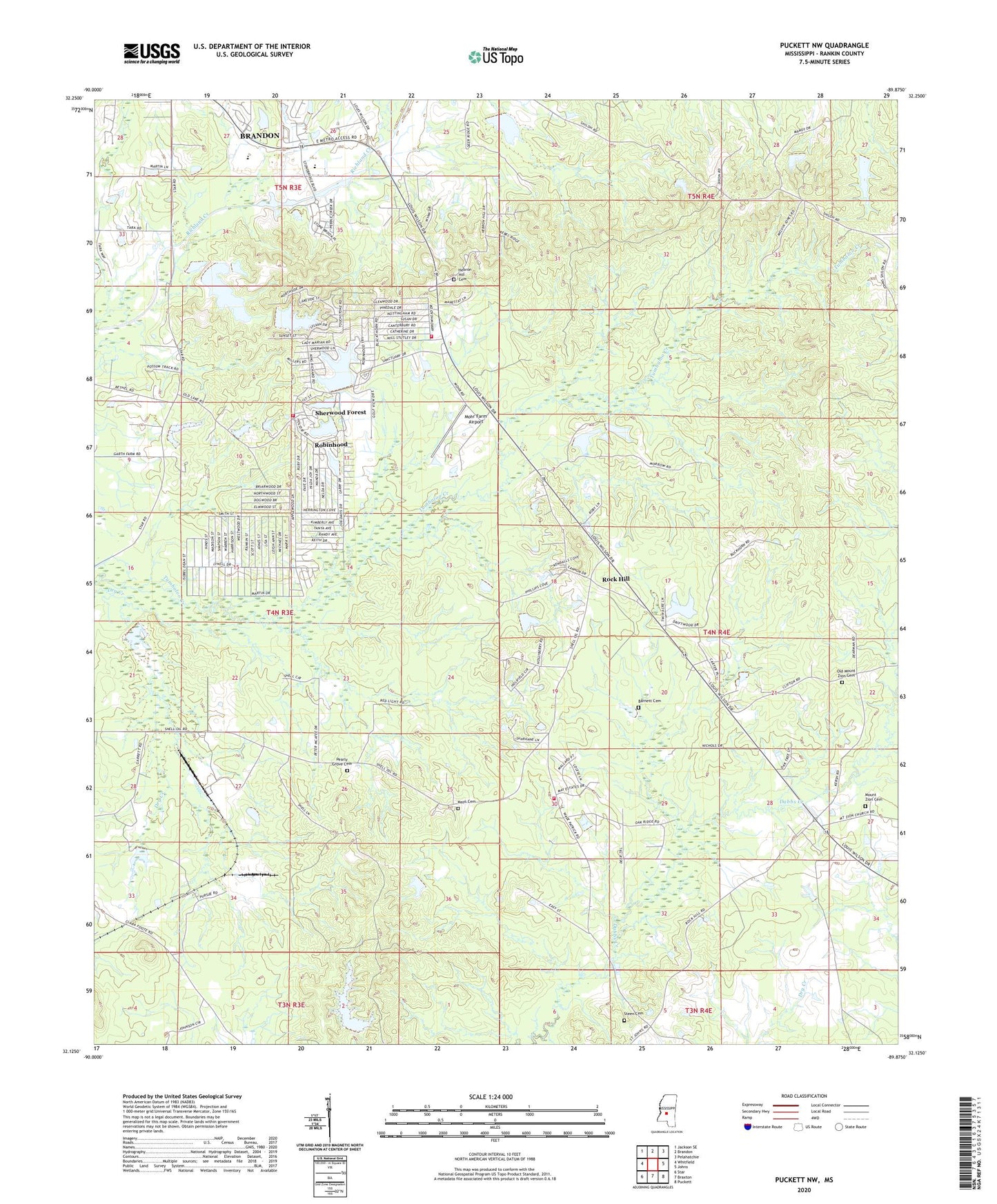
2020 topographic map quadrangle Puckett NW in the state of Mississippi. Scale: 1:24000. Based on the newly updated USGS 7.5' US Topo map series, this map is in the following counties: Rankin. The map contains contour data, water features, and other items you are used to seeing on USGS maps, but also has updated roads and other features. This is the next generation of topographic maps. Printed on high-quality waterproof paper with UV fade-resistant inks.
Quads adjacent to this one:
West: Whitfield
Northwest: Jackson SE
North: Brandon
Northeast: Pelahatchie
East: Johns
Southeast: Puckett
South: Braxton
Southwest: Star
Contains the following named places: Barnett Cemetery, Bethel School, Busick Lake Dam, Cone Hill Church, Crawford Lake Dam, Dobson, Eureka School, Fink Bine, Hebron Academy, Hebron Church, Hebron Hill Cemetery, Little Lake Dam, Mays Cemetery, Mohr Farm Airport, Morrow Lake Dam, Mount Zion Cemetery, Mount Zion Church, Mountain Ridge Cemetery, Old Mount Zion Cemetery, Pearlie Grove Church, Pearly Grove Cemetery, Robin Hood Lake Number 1 Dam, Robin Hood Lake Number 2 Dam, Robin Hood Lake Number 3 Dam, Robin Hood Lake Number 4 Dam, Robin Hood Lake Number 5 Dam, Robinhood Census Designated Place, Robinhood Church, Robinhood Lake, Robinhood Volunteer Fire Department Station 1, Robinhood Volunteer Fire Department Station 2, Rock Hill, Rock Hill Church, Shady Dell, Shady Grove School, Shell Road Volunteer Fire Department, Sherwood Forest, Steen Cemetery, Supervisor District 3, WRJH-FM (Brandon), ZIP Code: 39042