MyTopo
Star Mississippi US Topo Map
Couldn't load pickup availability
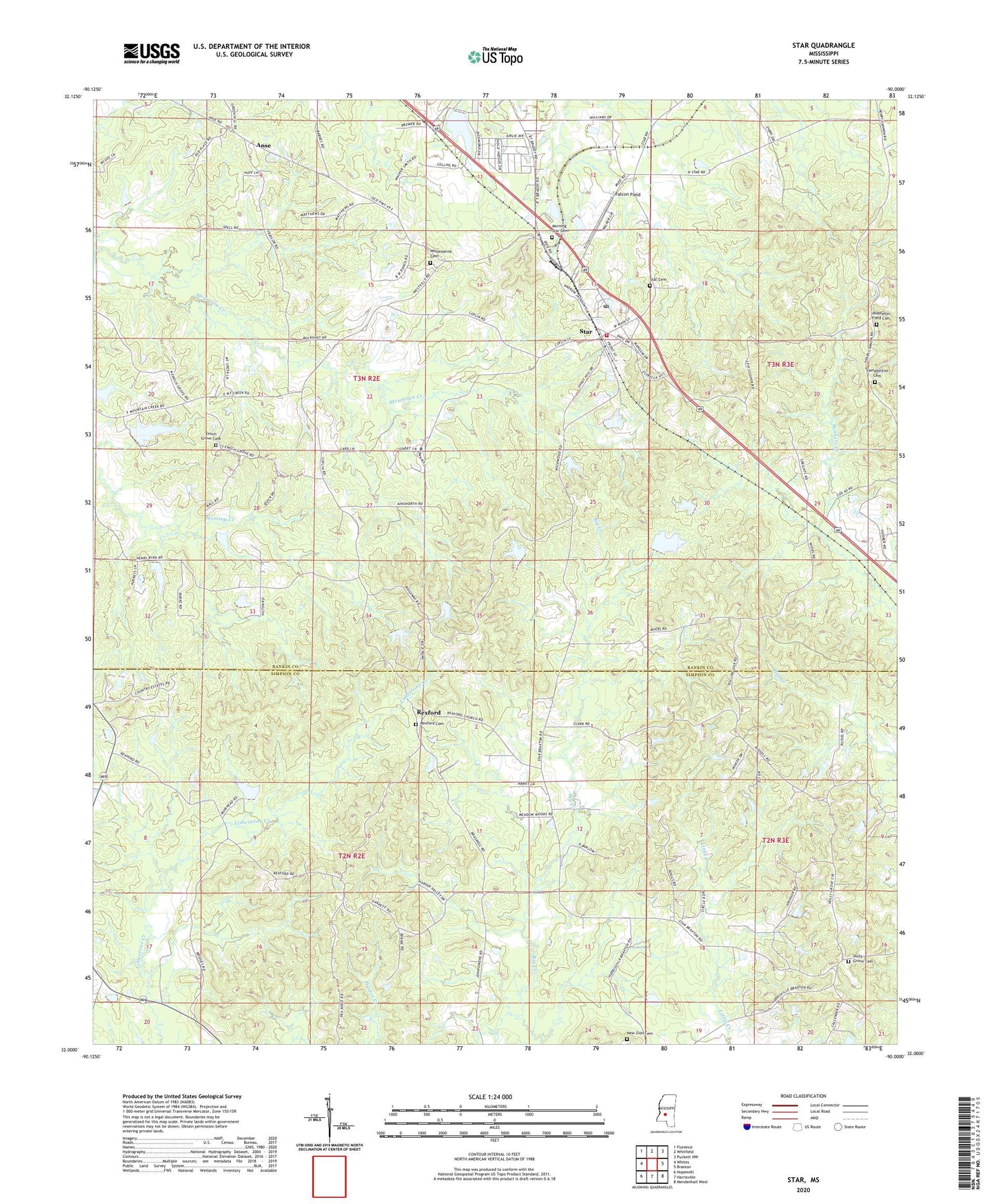
2024 topographic map quadrangle Star in the state of Mississippi. Scale: 1:24000. Based on the newly updated USGS 7.5' US Topo map series, this map is in the following counties: Rankin, Simpson. The map contains contour data, water features, and other items you are used to seeing on USGS maps, but also has updated roads and other features. This is the next generation of topographic maps. Printed on high-quality waterproof paper with UV fade-resistant inks.
Quads adjacent to this one:
West: Whites
Northwest: Florence
North: Whitfield
Northeast: Puckett NW
East: Braxton
Southeast: Mendenhall West
South: Harrisville
Southwest: Hopewell
This map covers the same area as the classic USGS quad with code o32090a1.
Contains the following named places: Anse, Belles Store, Bishops Lake Dam, Campbellite Cemetery, Campbellite Church, Comeby, Corley Lake Dam, Crenshaw Lake Dam, Dane, Enoch Grove Cemetery, Enoch Grove Church, Falcon Field, Fridge Lake Dam, Gama, Holly Grove Baptist Church, Holly Grove Cemetery, Lake Shores Lake Dam, Middleton Field Cemetery, Morning Star Cemetery, Mount Salem Church, New Zion Cemetery, New Zion Church, Oak Hill School, Rexford, Rexford Cemetery, Rexford Methodist Church, Ridgway Management Lake Dam, Rockhill School, Sardis School, Star, Star Cemetery, Star Post Office, Star Volunteer Fire Department, Wesleyanna Cemetery, Wesleyanna Church, ZIP Code: 39167