MyTopo
Braxton Mississippi US Topo Map
Couldn't load pickup availability
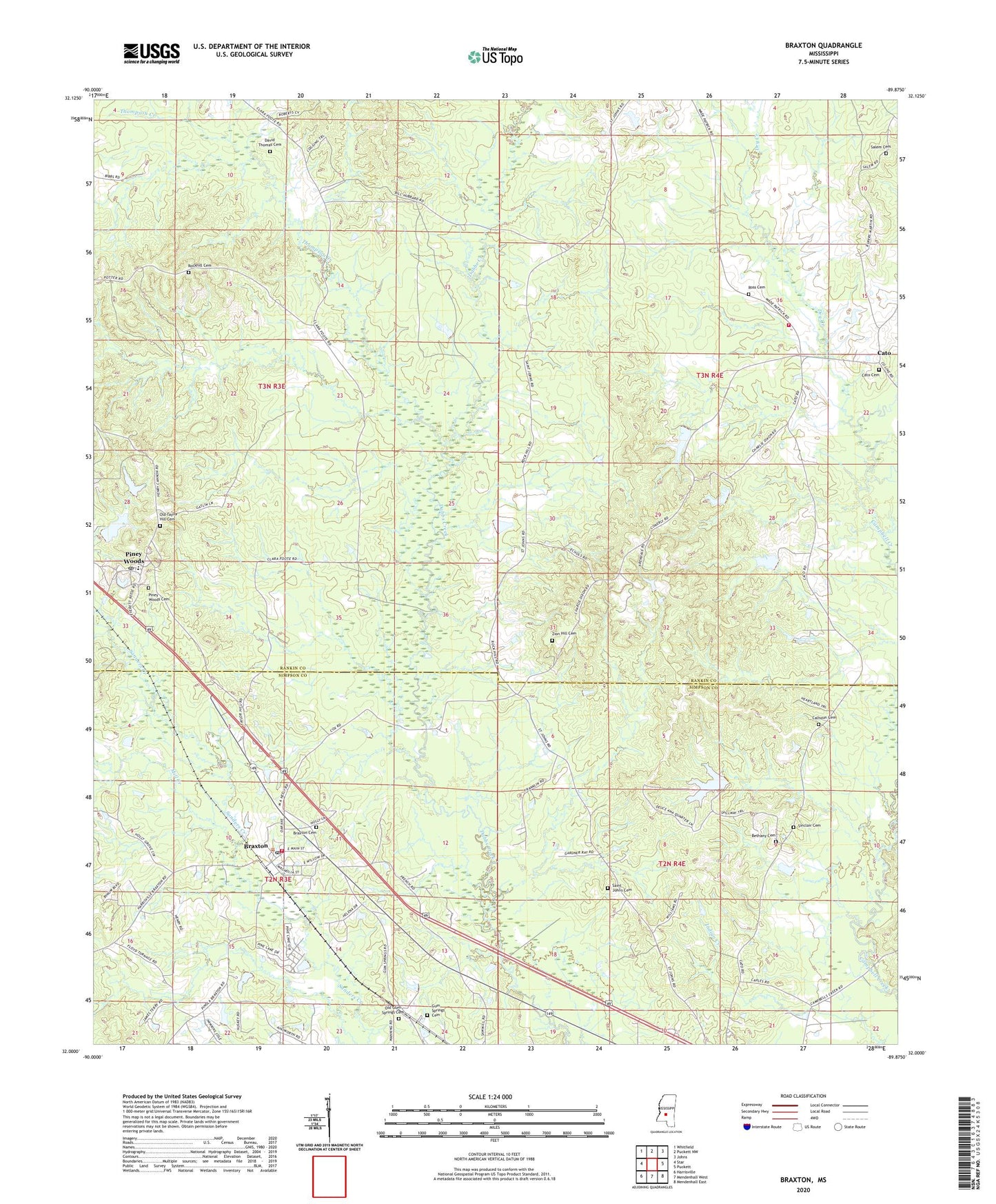
2024 topographic map quadrangle Braxton in the state of Mississippi. Scale: 1:24000. Based on the newly updated USGS 7.5' US Topo map series, this map is in the following counties: Rankin, Simpson. The map contains contour data, water features, and other items you are used to seeing on USGS maps, but also has updated roads and other features. This is the next generation of topographic maps. Printed on high-quality waterproof paper with UV fade-resistant inks.
Quads adjacent to this one:
West: Star
Northwest: Whitfield
North: Puckett NW
Northeast: Johns
East: Puckett
Southeast: Mendenhall East
South: Mendenhall West
Southwest: Harrisville
This map covers the same area as the classic USGS quad with code o32089a8.
Contains the following named places: Belpine, Bethany Cemetery, Bethany Church, Bethet School, Braxton, Braxton Baptist Church, Braxton Cemetery, Braxton Fire Rescue, Braxton Post Office, Calhoun Cemetery, Cato, Cato Cemetery, Cato Fire Department, Cato Lookout Tower, Cato School, Cato Springs Baptist Church, David Thomas Cemetery, Davis Lake Dam, Dry Creek, Easterling School, George, Gum Springs, Gum Springs Cemetery, Gum Springs Church, John Phillips Lake Dam, Mill Creek, Mrs W G McGee Lake Dam, Old Gum Springs Cemetery, Old Taylor Hill Cemetery, Phillips Lake, Pine Lake, Piney Woods, Piney Woods Cemetery, Piney Woods Country Life School, Piney Woods Lake Dam, Piney Woods Post Office, Rock Hill Church, Rockhill Cemetery, Ross Cemetery, Saint Johns Cemetery, Saint Johns Church, Salem Cemetery, Sinclair Cemetery, Taylor Hill Church, Thompson Creek, Village of Braxton, Zion Hill Cemetery, ZIP Code: 39044