MyTopo
Red Banks Mississippi US Topo Map
Couldn't load pickup availability
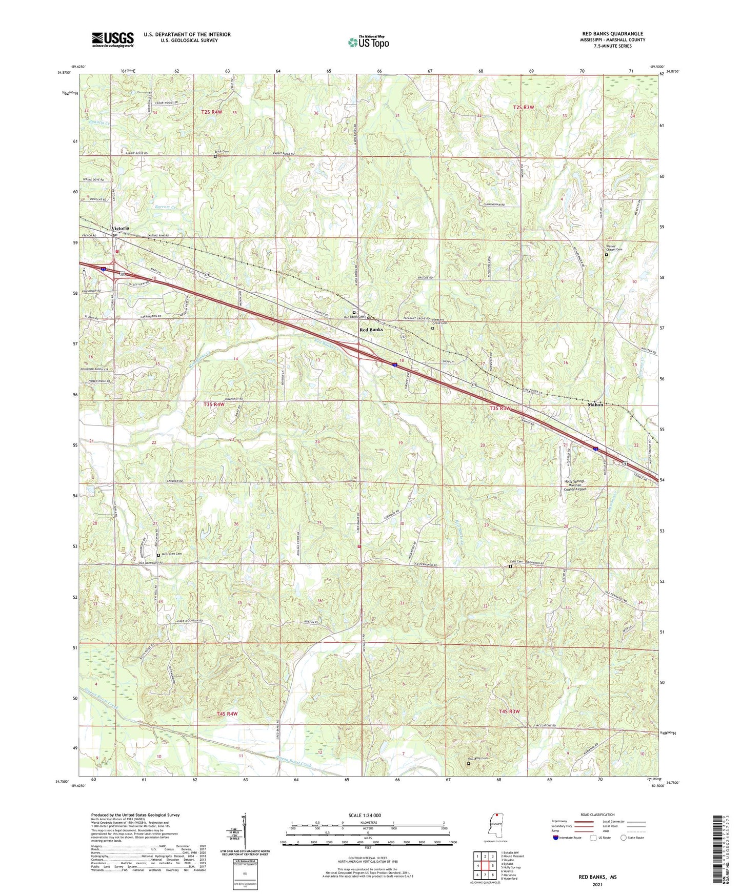
2021 topographic map quadrangle Red Banks in the state of Mississippi. Scale: 1:24000. Based on the newly updated USGS 7.5' US Topo map series, this map is in the following counties: Marshall. The map contains contour data, water features, and other items you are used to seeing on USGS maps, but also has updated roads and other features. This is the next generation of topographic maps. Printed on high-quality waterproof paper with UV fade-resistant inks.
Quads adjacent to this one:
West: Byhalia
Northwest: Byhalia NW
North: Mount Pleasant
Northeast: Slayden
East: Holly Springs
Southeast: Waterford
South: Marianna
Southwest: Wyatte
Contains the following named places: Adolphus School, Antioch Church, Brick Cemetery, Brick Church, Dowfords Chapel, Fant Cemetery, Hebron Chapel, Holly Springs-Marshall County Airport, Humphrey School, Lee School, Mahon, Marshall County, McCalley Lake Dam, McClathy Cemetery, McComb School, McCraven Cemetery, New Hope Church, New Hope School, Pleasant Grove Cemetery, Pleasant Grove Church, Pleasant Grove School, Red Banks, Red Banks Cemetery, Red Banks Census Designated Place, Red Banks Creek, Red Banks Post Office, Red Banks Volunteer Fire Department, Supervisor District 1, Tallaloosa, Thompson Consolidated School, Tunstall School, Victoria, Victoria Census Designated Place, Victoria Heights Baptist Church, Victoria Post Office, Victoria Volunteer Fire Department, Vinsons Chapel Church, Vinsons Chapel School, Wesley Chapel Cemetery, Wilson Chapel