MyTopo
Round Lake Mississippi US Topo Map
Couldn't load pickup availability
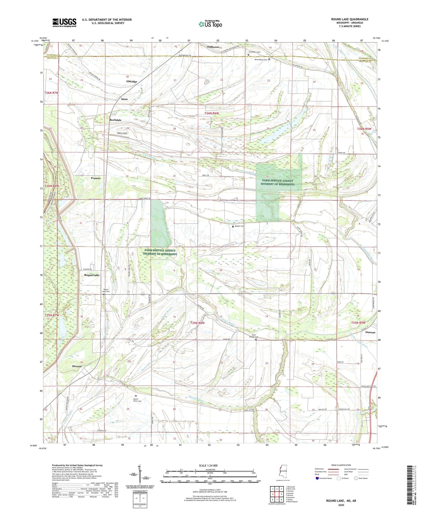
2020 topographic map quadrangle Round Lake in the state of Mississippi. Scale: 1:24000. Based on the newly updated USGS 7.5' US Topo map series, this map is in the following counties: Bolivar, Coahoma, Desha. The map contains contour data, water features, and other items you are used to seeing on USGS maps, but also has updated roads and other features. This is the next generation of topographic maps. Printed on high-quality waterproof paper with UV fade-resistant inks.
Quads adjacent to this one:
West: Laconia
Northwest: Mellwood
North: Rena Lara
Northeast: Sherard
East: Duncan
Southeast: Mound Bayou
South: Shelby
Southwest: Gunnison
Contains the following named places: Bethlehem Church, Booker Cemetery, Booker School, Brook Bayou, Buck Lake, Burken Church, Calvery Church, Cessions Revetment, Deeson, Dixie, Edward Bayou, Eldridge, Eldridge Church, Francis, Hooper Chapel, Hushpuckena, Island Lake, Jacob Church, Jerusalem Cemetery, Jerusalem Church, Johnson Kemper Church, Jones Bayou, King Solomon Church, King Solomon School, McNeil Slough, Midway Church, Moon Lake, Mount Hope Church, Mount Moriah Church, Mount Olive Cemetery, Mount Olive Church, New Ashbey Church, New Ashley Cemetery, New Ashley Church, New Macedonia Church, Old Macedonia Church, Rochdale, Round Lake, Round Lake Cemetery, Saint Joseph Cemetery, Saint Pauls Church, Stokes Bayou, Strangers Home Church, Sunrise Church, Virgin Mary Church, Watts Field, White Plains Church, Wildcat Slough, Wilkes Bayou, ZIP Codes: 38720, 38740