MyTopo
Gunnison Mississippi US Topo Map
Couldn't load pickup availability
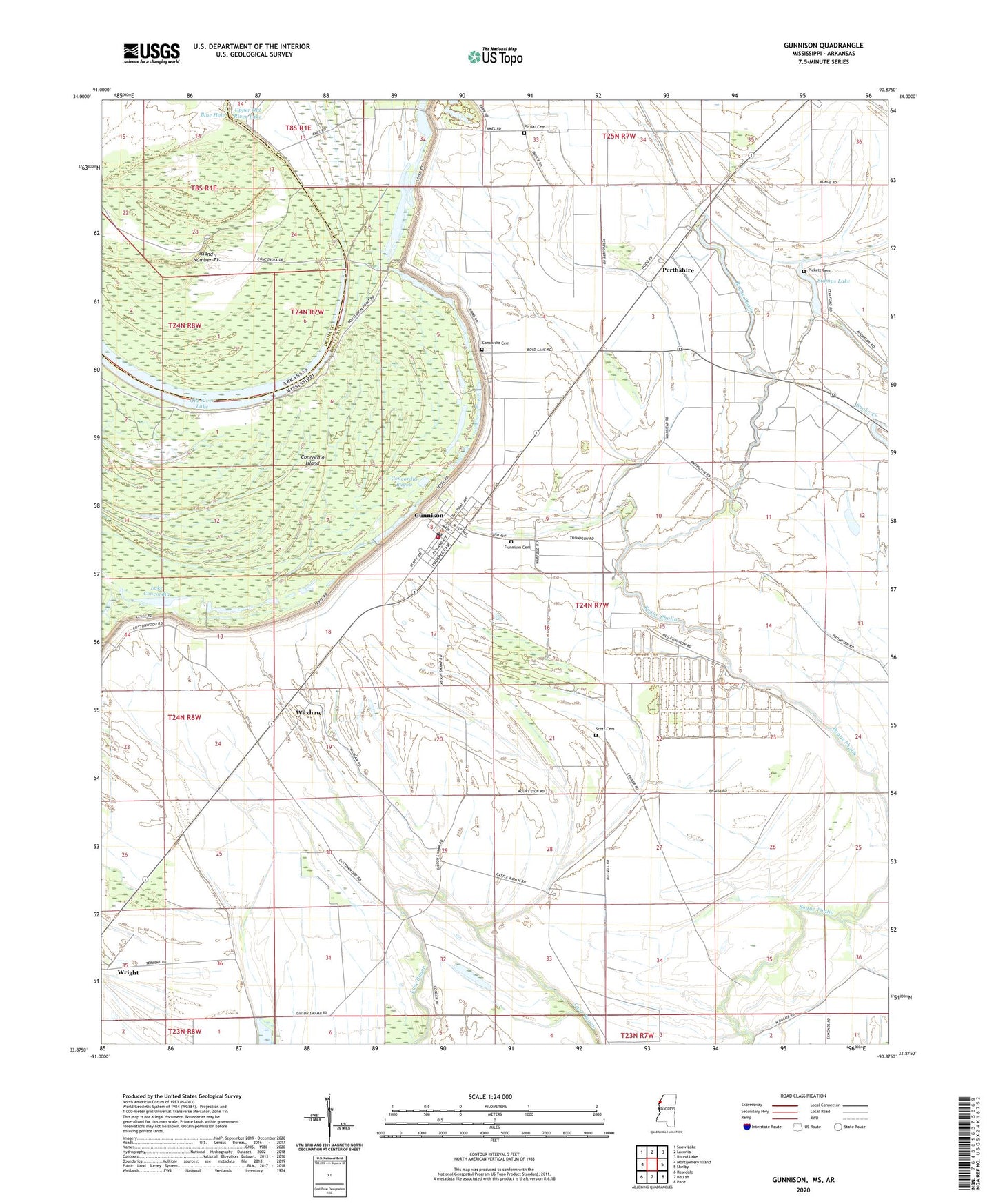
2024 topographic map quadrangle Gunnison in the states of Mississippi, Arkansas. Scale: 1:24000. Based on the newly updated USGS 7.5' US Topo map series, this map is in the following counties: Bolivar, Desha. The map contains contour data, water features, and other items you are used to seeing on USGS maps, but also has updated roads and other features. This is the next generation of topographic maps. Printed on high-quality waterproof paper with UV fade-resistant inks.
Quads adjacent to this one:
West: Montgomery Island
Northwest: Snow Lake
North: Laconia
Northeast: Round Lake
East: Shelby
Southeast: Pace
South: Beulah
Southwest: Rosedale
This map covers the same area as the classic USGS quad with code o33090h8.
Contains the following named places: Bassie Landing Field, Blue Hole, Bob Woods Elementary School, Bolivar County Fire Department District 4 Station 1 Gunnison, Carr Landing Field, Carsons Landing, Concordia, Concordia Bayou, Concordia Cemetery, Dalton Taylor Catfish Ponds Dam, Ditch Number Fourteen, Ditch Number Seven, Ditch Number Sixteen, Ditch Number Twelve, East Star Church, Ernest Finley Pond Dam, Gunnison, Gunnison Cemetery, Gunnison Post Office, Island Number 71, Island Number Seventy, Kirks Plantation, Lake Concordia, Mercy Seat Church, Morning Star Church, Mount Zion Church, New Bethel Church, Old River Lake, Person Cemetery, Perthshire, Perthshire Landing Field, Pickett Cemetery, Round Lake, Saint John Church, Scott Cemetery, Shady Grove Church, Shiloh Church, Sledge Crevasse, Stamps Lake, Town of Gunnison, Tree of Life Church, Union Grove Church, Upper Old River Lake, Waxhaw, Waxhaw Church, Wright, ZIP Code: 38746