MyTopo
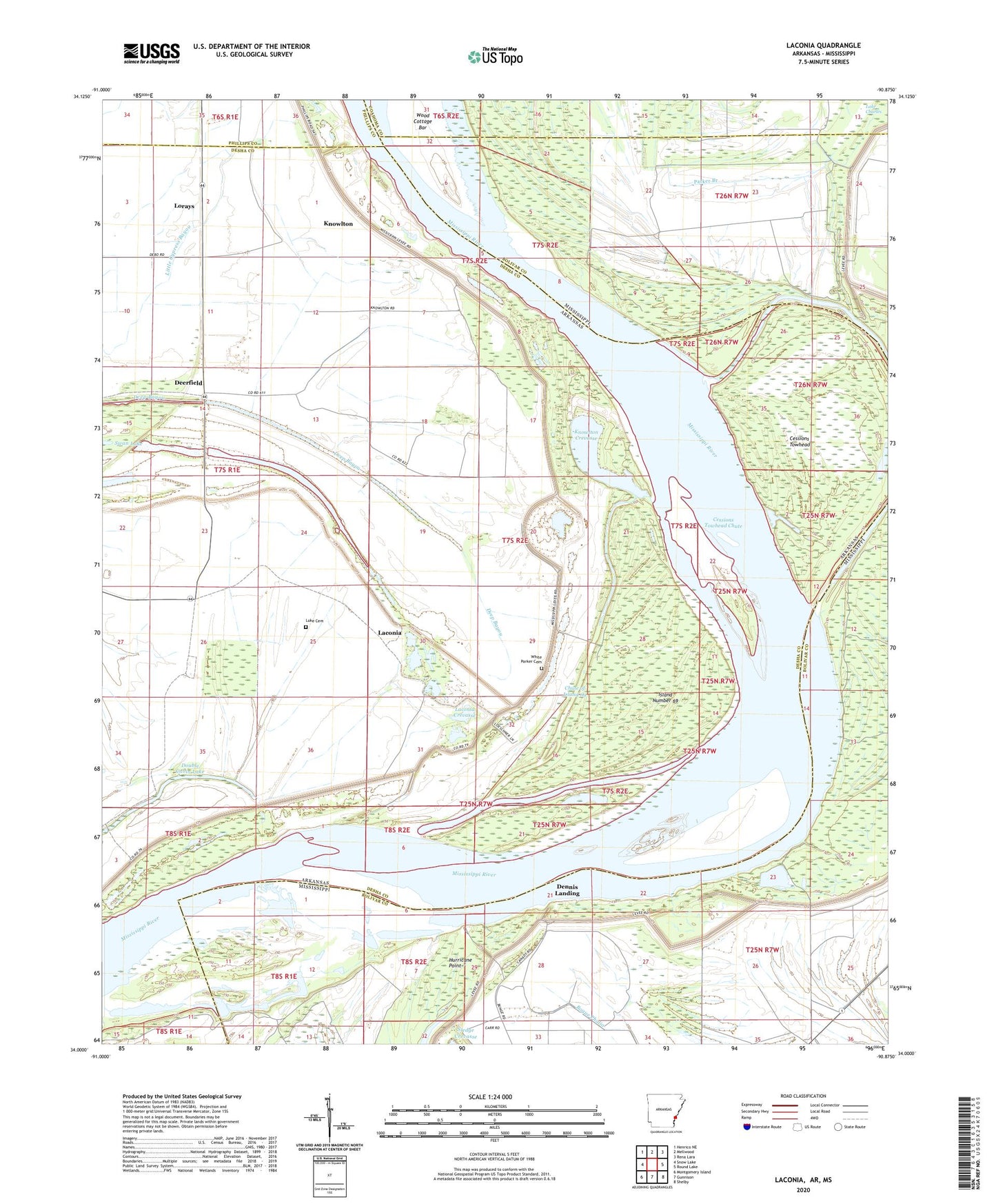
Laconia Arkansas US Topo Map
Couldn't load pickup availability
2024 topographic map quadrangle Laconia in the states of Arkansas, Mississippi. Scale: 1:24000. Based on the newly updated USGS 7.5' US Topo map series, this map is in the following counties: Desha, Bolivar, Coahoma, Phillips. The map contains contour data, water features, and other items you are used to seeing on USGS maps, but also has updated roads and other features. This is the next generation of topographic maps. Printed on high-quality waterproof paper with UV fade-resistant inks.
Quads adjacent to this one:
West: Snow Lake
Northwest: Henrico NE
North: Mellwood
Northeast: Rena Lara
East: Round Lake
Southeast: Shelby
South: Gunnison
Southwest: Montgomery Island
Contains the following named places: Anarke School, Antioch Church, Australia Landing, Beith Landing, Below Knowlton Dikes, Brushy Lake, Cessions Landing, Cessions Towhead, Cessions Towhead Chute, Cessions Towhead Revetment, Chute of Island 69, Deerfield, Dennis Landing, Dennis Revetment, Double Cabin Lake, Fish Lake, Henrico Revetment, Hurricane Point, Island Number 69, Knowlton, Knowlton Crevasse, Knowlton Landing, Knowlton Revetment, Laconia, Laconia Crevasse, Laconia Landing, Lake Charles, Lorays, Luke Cemetery, Mason Landing, Mount Pleasant Church, Mount Table Church, Parker Branch, Pleasant Valley Church, Swan Lake, White Parker Cemetery, Wood Cottage Bar, Zion Chapel