MyTopo
Sandersville Mississippi US Topo Map
Couldn't load pickup availability
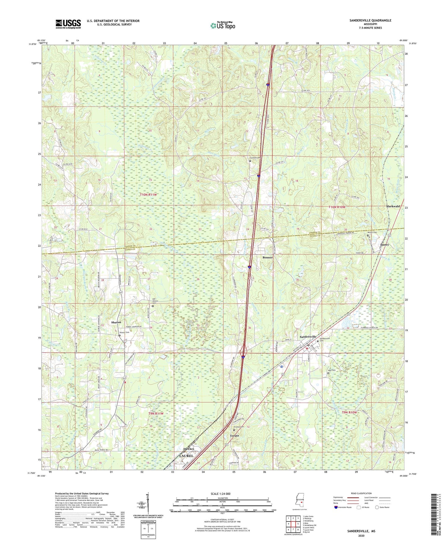
2024 topographic map quadrangle Sandersville in the state of Mississippi. Scale: 1:24000. Based on the newly updated USGS 7.5' US Topo map series, this map is in the following counties: Jones, Jasper. The map contains contour data, water features, and other items you are used to seeing on USGS maps, but also has updated roads and other features. This is the next generation of topographic maps. Printed on high-quality waterproof paper with UV fade-resistant inks.
Quads adjacent to this one:
West: Moss
Northwest: Lake Como
North: Waldrup
Northeast: Heidelberg
East: Heidelberg SW
Southeast: Myrick
South: Laurel East
Southwest: Laurel West
This map covers the same area as the classic USGS quad with code o31089g1.
Contains the following named places: Bethlehem Church, Billy Hill Reedy Creek, Black Branch, Bonner, Bonner Store, Corinth Cemetery, Corinth Missionary Baptist Church, Dry Creek, Erata School, Errata, Errata Lookout Tower, Erratta Cemetery, Erratta Church, Fergusons Bridge, First Baptist Church of Sharon, Haney, Haney Branch, Hart Ditch, Hawkes, Hoy School, Jim Kelly Branch, Kuykendall Branch, Liberty Church, Lindsey School, Markwald, May Cemetery, Mayhaw Branch, McFarland School, McGill Cemetery, Mill Creek, Mount Moriah Baptist Church, Mount Pleasant Baptist Church, Mount Zion Church, Old Julie Branch, Old Sharon Cemetery, Prairie Creek, Red Hill Church, Red Hill School, Sandersville, Sandersville Baptist Church, Sandersville Cemetery, Sandersville Elementary School, Sandersville Police Department, Sandersville Post Office, Sandersville Volunteer Fire Department, Sharon, Sharon Cemetery, Sharon Census Designated Place, Sharon Elementary School, Sharon Oil Field, Sharon Volunteer Fire Department, Tallahattah Creek, Town of Sandersville, Victory Missionary Baptist Church, Wesley Chapel, West Reedy Creek, Whynot Church, ZIP Codes: 39439, 39477