MyTopo
Sanford Mississippi US Topo Map
Couldn't load pickup availability
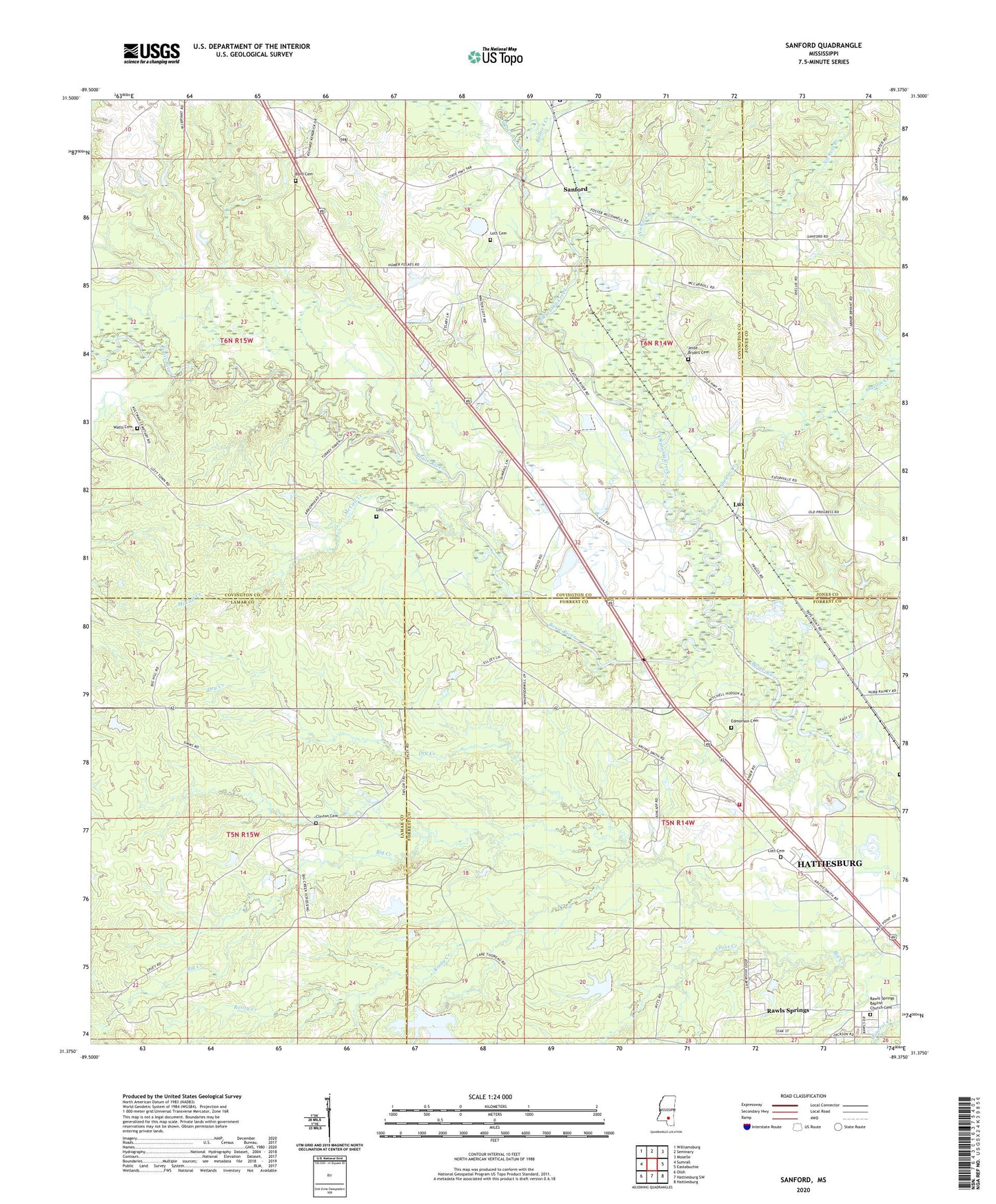
2024 topographic map quadrangle Sanford in the state of Mississippi. Scale: 1:24000. Based on the newly updated USGS 7.5' US Topo map series, this map is in the following counties: Covington, Forrest, Lamar, Jones. The map contains contour data, water features, and other items you are used to seeing on USGS maps, but also has updated roads and other features. This is the next generation of topographic maps. Printed on high-quality waterproof paper with UV fade-resistant inks.
Quads adjacent to this one:
West: Sumrall
Northwest: Williamsburg
North: Seminary
Northeast: Moselle
East: Eastabuchie
Southeast: Hattiesburg
South: Hattiesburg SW
Southwest: Oloh
This map covers the same area as the classic USGS quad with code o31089d4.
Contains the following named places: Bay Springs School, Bowie Creek Landing Boat Ramp, Bullock Creek, Byrd Cemetery, Clinton Cemetery, Cross Creek, Dry Creek, Ed Turner Lake Dam, Edmonson Cemetery, First Baptist Church of Sanford, Grandberry Plantation, Jesse Bryant Cemetery, Lott Cemetery, Lux, Lux Church, Lux School, McCall Creek, Nichols Branch, Okatoma Creek, Rawl Springs Volunteer Fire Department, Rawls Cemetery, Rawls Springs Baptist Church Cemetery, Rawls Springs Census Designated Place, Rawls Springs Community Center, Rooty Creek, Sacier Pond Dam, Sanford, Sanford Academy, Sanford Missionary Baptist Church, Sanford School, Sanford United Methodist Church, Shady Cove Recreational Vehicle Campground, Shelton Creek, Simmons Airport, Stir, Sutton School, Watts Cemetery