
MyTopo
Schley Mississippi US Topo Map
Couldn't load pickup availability
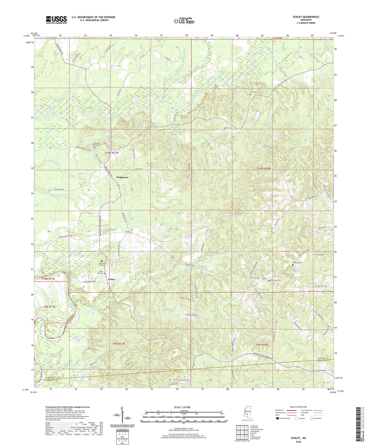
2024 topographic map quadrangle Schley in the state of Mississippi. Scale: 1:24000. Based on the newly updated USGS 7.5' US Topo map series, this map is in the following counties: Simpson, Lawrence, Copiah. The map contains contour data, water features, and other items you are used to seeing on USGS maps, but also has updated roads and other features. This is the next generation of topographic maps. Printed on high-quality waterproof paper with UV fade-resistant inks.
Quads adjacent to this one:
West: Georgetown
Northwest: Hopewell
North: Harrisville
Northeast: Mendenhall West
East: Shivers
Southeast: New Hebron
South: Monticello NE
Southwest: Oma
This map covers the same area as the classic USGS quad with code o31090g1.
Contains the following named places: Armstrong-Buckley Cemetery, Banks Creek, Big Creek, Bridgeport, Bridgeport School, Copper Branch, Cottonseed Branch, Dickerson Lake, Dickersons Mill, Double S Farms, Dry Creek, Durden Branch, John Sherman Lake Dam, Lee Branch, Lee Cemetery, Martin Lake, Mill Creek, New Hope Cemetery, New Hope Church, Oak Ridge Church, Peacock Cemetery, Pleasant Hill Cemetery, Pleasant Hill Church, Pokal, Pole Branch, Schley, Shivers Lookout Tower, Sinkler Branch, South Branch Vaughns Creek, Springhill Church, Taylor Hill Cemetery, Taylor Hill Church, Vaughns Creek, Walker Taylor Branch, Williams Creek, ZIP Code: 39149


