
MyTopo
Georgetown Mississippi US Topo Map
Couldn't load pickup availability
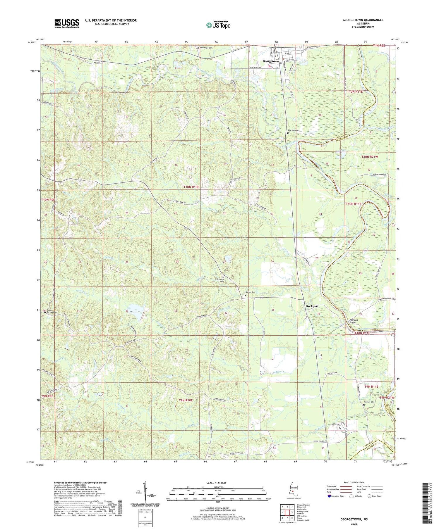
2024 topographic map quadrangle Georgetown in the state of Mississippi. Scale: 1:24000. Based on the newly updated USGS 7.5' US Topo map series, this map is in the following counties: Copiah, Simpson, Lawrence. The map contains contour data, water features, and other items you are used to seeing on USGS maps, but also has updated roads and other features. This is the next generation of topographic maps. Printed on high-quality waterproof paper with UV fade-resistant inks.
Quads adjacent to this one:
West: Shady Grove
Northwest: Crystal Springs
North: Hopewell
Northeast: Harrisville
East: Schley
Southeast: Monticello NE
South: Oma
Southwest: Stronghope
This map covers the same area as the classic USGS quad with code o31090g2.
Contains the following named places: Ashley Lookout Tower, Coaler, Copiah Creek, Cowanville, Durr Farm Pond Dam, Galilee Cemetery, Galilee Church, Georgetown, Georgetown Post Office, Georgetown Volunteer Fire Department, Indian Creek, Keys Creek, Kinnaird, Lick Creek, Lily Mae Cemetery, Lowe Cemetery, Massey Branch, New Hope Cemetery, New Hope Church, Norman Cemetery, Old Georgetown, Pearl Valley Baptist Church, Pegies Creek, Poplar Springs Cemetery, Poplar Springs Church, Potato Branch, Providence Cemetery, Providence Church, Rockport, Rockport Bridge, Steel Creek, Strong River, Town of Georgetown


