MyTopo
Harrisville Mississippi US Topo Map
Couldn't load pickup availability
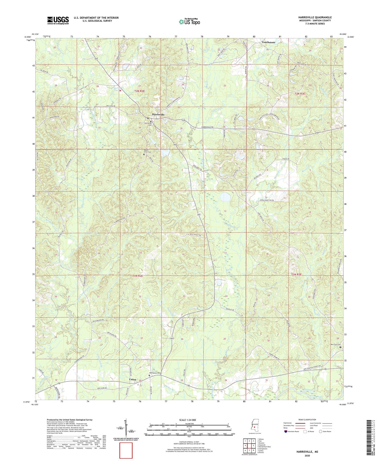
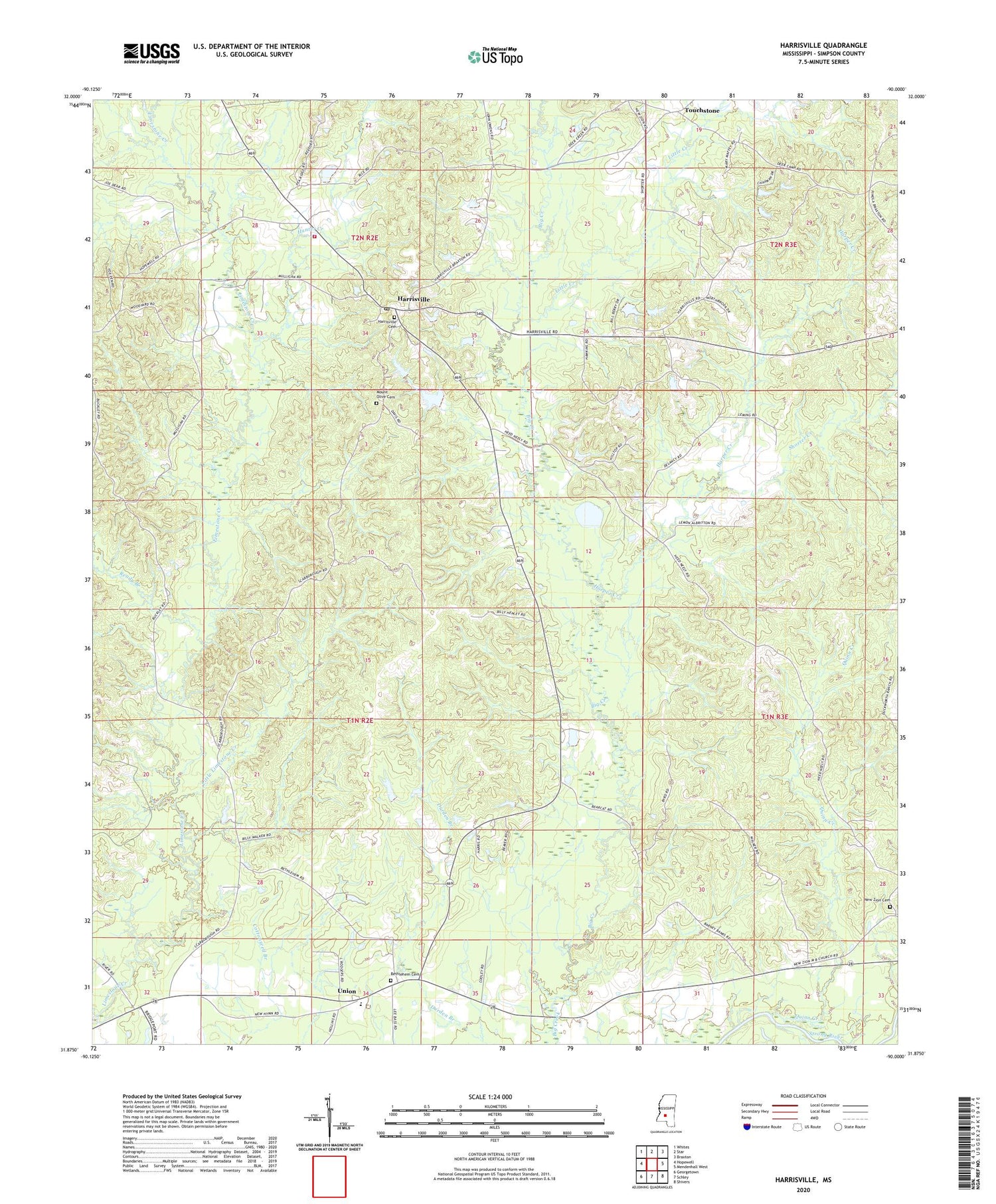
2024 topographic map quadrangle Harrisville in the state of Mississippi. Scale: 1:24000. Based on the newly updated USGS 7.5' US Topo map series, this map is in the following counties: Simpson. The map contains contour data, water features, and other items you are used to seeing on USGS maps, but also has updated roads and other features. This is the next generation of topographic maps. Printed on high-quality waterproof paper with UV fade-resistant inks.
Quads adjacent to this one:
West: Hopewell
Northwest: Whites
North: Star
Northeast: Braxton
East: Mendenhall West
Southeast: Shivers
South: Schley
Southwest: Georgetown
This map covers the same area as the classic USGS quad with code o31090h1.
Contains the following named places: Bethlehem Baptist Church, Bethlehem Cemetery, Bluff Springs School, Calhoun Branch, Crum School, Doctor W G Munn Lake Dam, G D Neely Lake Dam, Harper Creek, Harrisville, Harrisville Attendance Center, Harrisville Baptist Church, Harrisville Cemetery, Harrisville Post Office, Harrisville Volunteer Fire Department, Hunter Creek, Little Creek, Little Limestone Creek, Loretta School, Midway School, Mount Olive Cemetery, Mount Olive Church, Mount Pisgah Church, New Covenant Church, New Hym Missionary Baptist Church, New Zion Cemetery, New Zion Church, Perline School, Pine Ridge School, Quinn Creek, Ready Branch, Shorter Creek, Spring Hills Church, Spring Valley Church, Supervisor District 5, Touchstone, Union, ZIP Code: 39082