MyTopo
Scott Mississippi US Topo Map
Couldn't load pickup availability
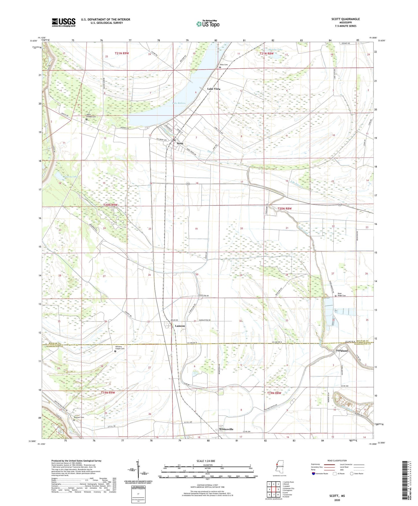
2020 topographic map quadrangle Scott in the state of Mississippi. Scale: 1:24000. Based on the newly updated USGS 7.5' US Topo map series, this map is in the following counties: Bolivar, Washington. The map contains contour data, water features, and other items you are used to seeing on USGS maps, but also has updated roads and other features. This is the next generation of topographic maps. Printed on high-quality waterproof paper with UV fade-resistant inks.
Quads adjacent to this one:
West: Arkansas City
Northwest: Catfish Point
North: Benoit
Northeast: Lobdell
East: Stringtown
Southeast: Leland
South: Greenville
Southwest: Luna
Contains the following named places: Bell Airport, Brushy Lake, Buckner Cemetery, Bull Bayou, Dean Ridge Cemetery, Forkland, Forkland Church, Gospel Light Church, Grassy Lake, Jerusalem Church, Lake Bolivar, Lake Vista, Lamont, Little Rock Church, Miles Cemetery, Mount Olive Church, Mount Tanya Church, Muddy Grove Church, Nugent Church, Saint Johns Church, Saint Joseph Church, Saint Pauls Church, Saint Thomas Church, Scott, Scott Census Designated Place, Scott Post Office, Silver Mount Church, Springfield Church, Straight Bayou, Swan Lake, Ward Chapel, Ward Chapel Cemetery, Williams Bayou, Williams Chapel, Williams Chapel Cemetery, Winterville, Winterville Census Designated Place, ZIP Code: 38772