MyTopo
Sebastopol Mississippi US Topo Map
Couldn't load pickup availability
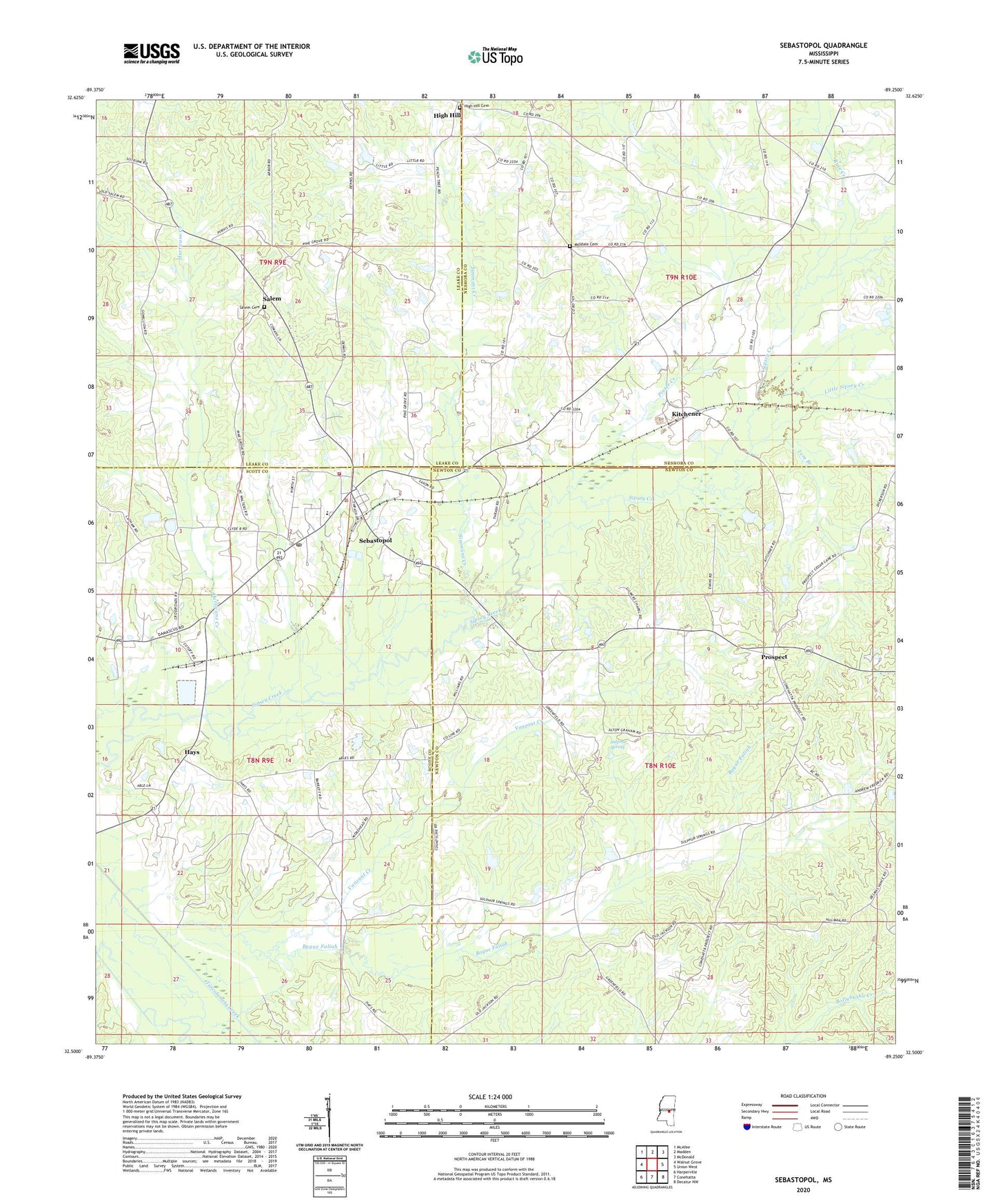
2020 topographic map quadrangle Sebastopol in the state of Mississippi. Scale: 1:24000. Based on the newly updated USGS 7.5' US Topo map series, this map is in the following counties: Newton, Scott, Neshoba, Leake. The map contains contour data, water features, and other items you are used to seeing on USGS maps, but also has updated roads and other features. This is the next generation of topographic maps. Printed on high-quality waterproof paper with UV fade-resistant inks.
Quads adjacent to this one:
West: Walnut Grove
Northwest: McAfee
North: Madden
Northeast: McDonald
East: Union West
Southeast: Decatur NW
South: Conehatta
Southwest: Harperville
Contains the following named places: Bethelehem Church, Bogue Faliah, Chestnut Ridge School, Crossroad Church, Dollars Store, Don Landrum Lake Dam, Gilmers Church, Green Acre Farm Sewage Pond Dam, Greenfield, Hays, High Hill, High Hill Cemetery, High Hill Church, Hurricane Creek, Kitchener, Little Sipsey Creek, Milldale Cemetery, Moores Mill, Pine Grove Church, Pinter Creek, Pleasant Valley Church, Prospect, Prospect Church, R C Camp Lake Dam, Race Creek, Reids Chapel, Rocky Hill Church, Salem, Salem Cemetery, Salem School, Sebastopol, Sebastopol Attendance Center, Sebastopol Baptist Church, Sebastopol Post Office, Simmons Creek, Steam Mill Church, Stribbings Store, Sulphur Spring, Sulphur Springs Church, Tom Branch, Town of Sebastopol, Vance Mill, Vanzant Creek, White Plains Church, ZIP Code: 39359