MyTopo
Sharon Mississippi US Topo Map
Couldn't load pickup availability
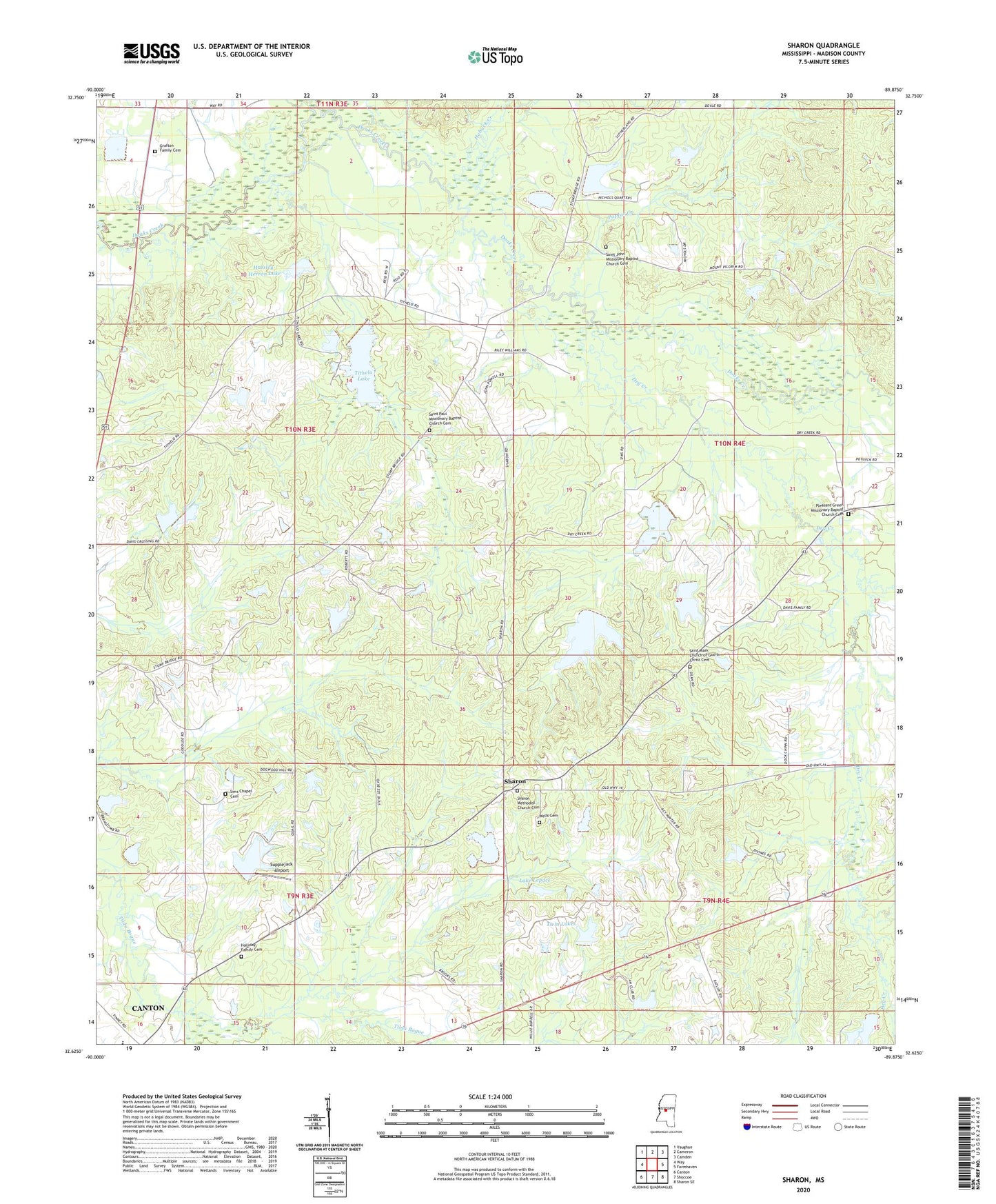
2020 topographic map quadrangle Sharon in the state of Mississippi. Scale: 1:24000. Based on the newly updated USGS 7.5' US Topo map series, this map is in the following counties: Madison. The map contains contour data, water features, and other items you are used to seeing on USGS maps, but also has updated roads and other features. This is the next generation of topographic maps. Printed on high-quality waterproof paper with UV fade-resistant inks.
Quads adjacent to this one:
West: Way
Northwest: Vaughan
North: Cameron
Northeast: Camden
East: Farmhaven
Southeast: Sharon SE
South: Shoccoe
Southwest: Canton
Contains the following named places: Dry Creek, Grafton Family Cemetery, Hagin Creek, Hassley-Herron Lake, Hassley-Herron Lake Dam, Hobuck Creek, Holliday Family Cemetery, Huckleberry Hills Lake Dam, Huckleberry Lake Dam, L S Farms Lake Dam, Lake Lepace, Lottville Creek, Mississippi State Extension Lake Dam, Mount Zion Church, New Garden Church, Pleasant Green Church, Pleasant Green Missionary Baptist Church Cemetery, Pleasant Green School, Poplar Creek, S S Divine Lake Dam, Saint John Church, Saint John Missionary Baptist Church Cemetery, Saint Mark Church, Saint Mark Church of God In Christ Cemetery, Saint Paul Church, Saint Paul Missionary Baptist Church Cemetery, Sharon, Sharon Church, Sharon Methodist Church, Sharon Methodist Church Cemetery, Sharon Post Office, Sims Chapel, Sims Chapel Cemetery, Smithville Church, Stump Bridge, Stump Bridge Post Office, Supervisor District 5, Supplejack Airport, Tip Ray Lake Dam, Tithelo Lake, Tithelo Lake Dam, Turnetta, Twin Lakes, Twin Lakes Dam, Wells Cemetery, ZIP Code: 39046