MyTopo
Silver Run Mississippi US Topo Map
Couldn't load pickup availability
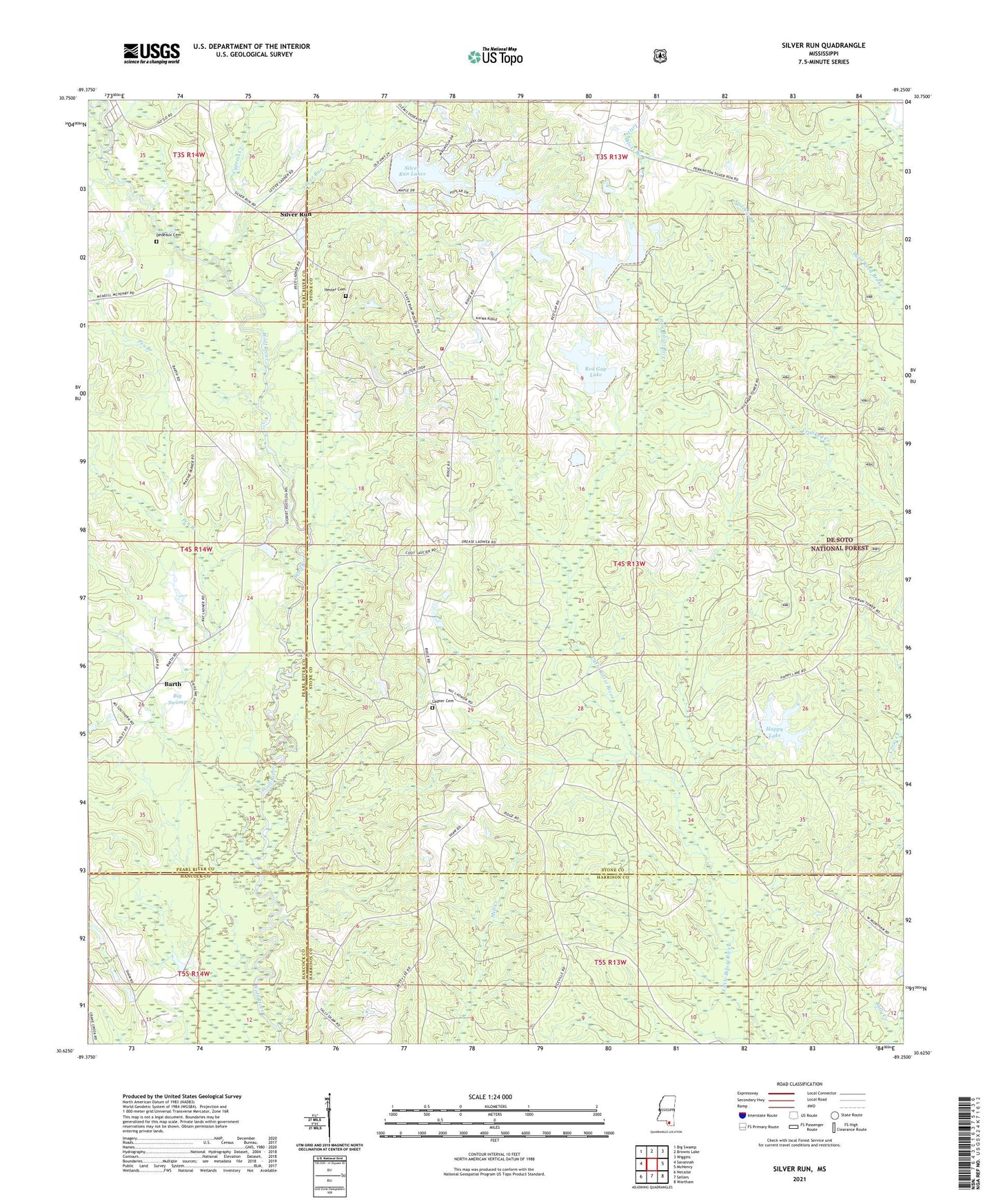
2021 topographic map quadrangle Silver Run in the state of Mississippi. Scale: 1:24000. Based on the newly updated USGS 7.5' US Topo map series, this map is in the following counties: Stone, Pearl River, Harrison, Hancock. The map contains contour data, water features, and other items you are used to seeing on USGS maps, but also has updated roads and other features. This is the next generation of topographic maps. Printed on high-quality waterproof paper with UV fade-resistant inks.
Quads adjacent to this one:
West: Savannah
Northwest: Big Swamp
North: Browns Lake
Northeast: Wiggins
East: McHenry
Southeast: Wortham
South: Sellers
Southwest: Necaise
Contains the following named places: Barth, Beesum Lake Dam, Big Swamp, Biloxi Creek Church, Cypress Creek, Dedeaux Cemetery, Happy Lake, Happy Lake Dam, Harsh Lake Dam, Hester Cemetery, Hickman Lookout Tower, Ladner Cemetery, Leo Harrolds Lake Dam, Oak Grove Church, Old Barth Community Church, Pen Branch, Red Gap Lake, Red Gap Lake Dam, Red Gap Lakes, Rogers Lake, Rogers Lake Dam, Rufus Shaw Lake Dam, Silver Run, Silver Run Baptist Church, Silver Run Lake, Silver Run Lake Dam, Silver Run Lakes, Silver Run School, Silver Run Volunteer Fire Department