MyTopo
Necaise Mississippi US Topo Map
Couldn't load pickup availability
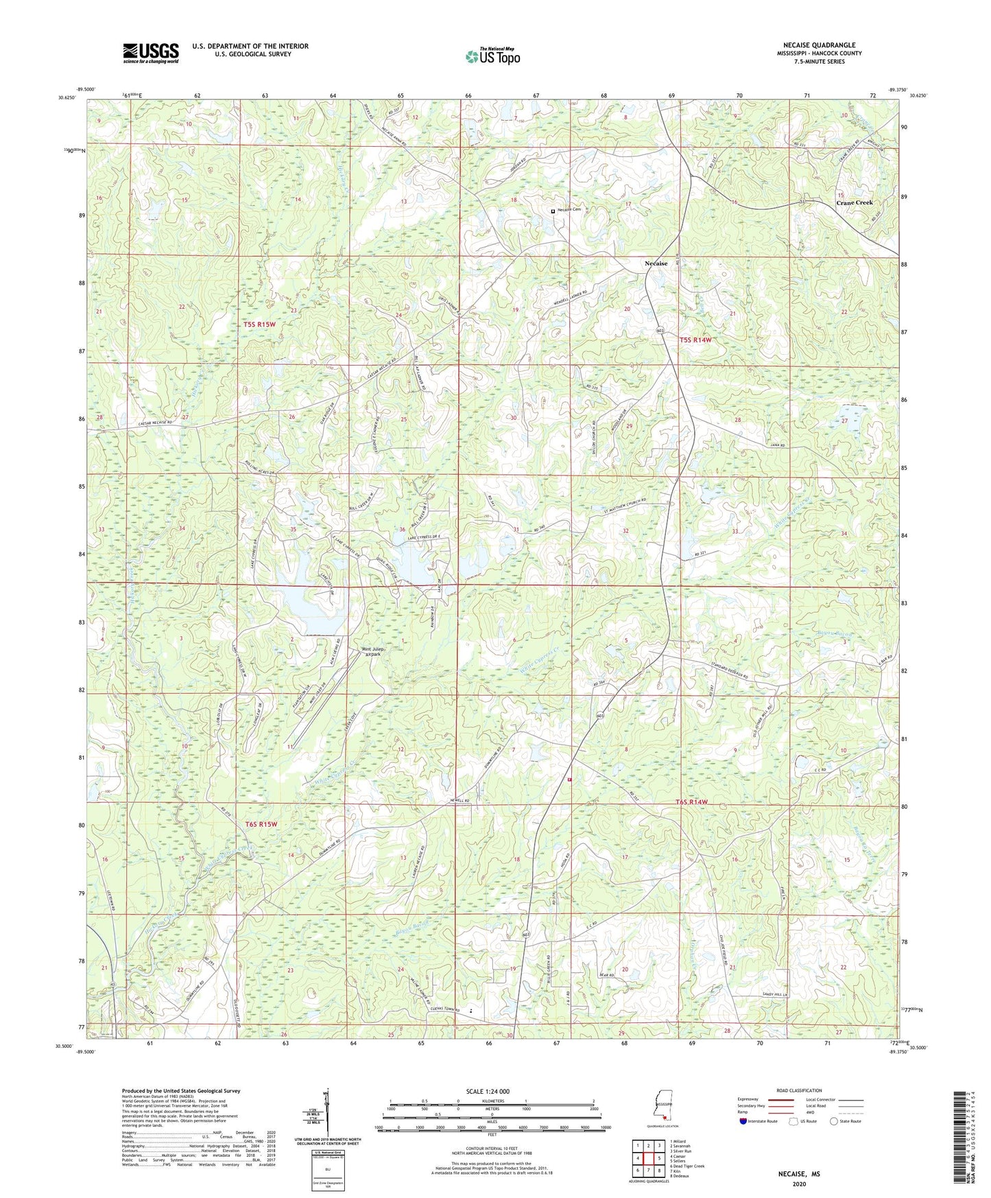
2024 topographic map quadrangle Necaise in the state of Mississippi. Scale: 1:24000. Based on the newly updated USGS 7.5' US Topo map series, this map is in the following counties: Hancock. The map contains contour data, water features, and other items you are used to seeing on USGS maps, but also has updated roads and other features. This is the next generation of topographic maps. Printed on high-quality waterproof paper with UV fade-resistant inks.
Quads adjacent to this one:
West: Caesar
Northwest: Millard
North: Savannah
Northeast: Silver Run
East: Sellers
Southeast: Dedeaux
South: Kiln
Southwest: Dead Tiger Creek
This map covers the same area as the classic USGS quad with code o30089e4.
Contains the following named places: B M Brignse Lake Dam, Bennett, Bobby Sides Lake Dam, Crane Creek, Crane Creek Church, Cuevas Lake Dam, Hancock North Central High School, Mint Julep Airpark, Necaise, Necaise Crossing Cemetery, Necaise Lake Dam, Necaise Lootout Tower, Post 58 Volunteer Fire Department Station 1, Saint Matthew the Apostle Church, Sellers Lookout Tower, Shiloh Church, Smith Lake Dam, Standard, Victory Church, White Cypress Church, White Cypress Creek