MyTopo
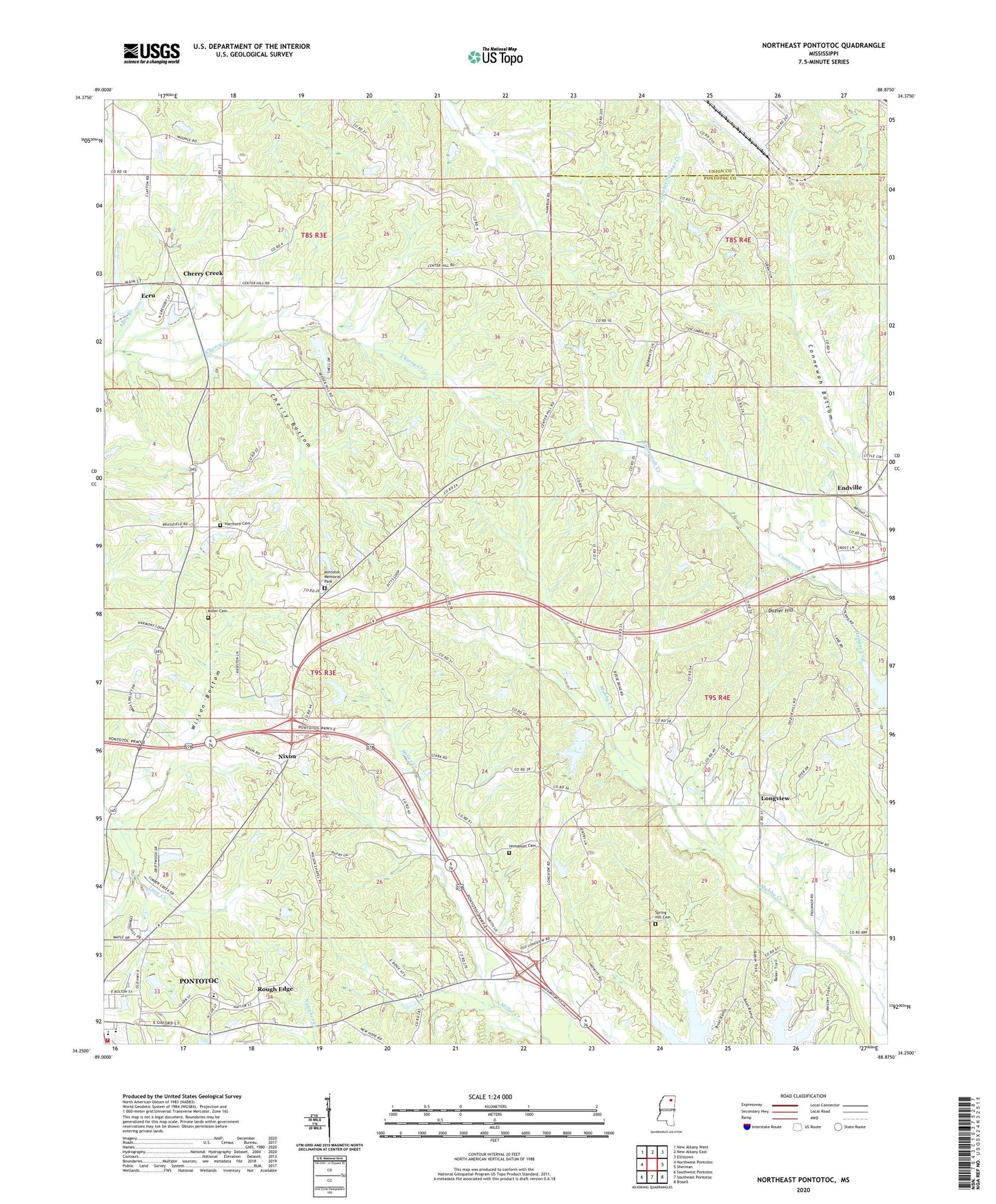
Northeast Pontotoc Mississippi US Topo Map
Couldn't load pickup availability
2024 topographic map quadrangle Northeast Pontotoc in the state of Mississippi. Scale: 1:24000. Based on the newly updated USGS 7.5' US Topo map series, this map is in the following counties: Pontotoc, Union. The map contains contour data, water features, and other items you are used to seeing on USGS maps, but also has updated roads and other features. This is the next generation of topographic maps. Printed on high-quality waterproof paper with UV fade-resistant inks.
Quads adjacent to this one:
West: Northwest Pontotoc
Northwest: New Albany West
North: New Albany East
Northeast: Ellistown
East: Sherman
Southeast: Bissell
South: Southeast Pontotoc
Southwest: Southwest Pontotoc
This map covers the same area as the classic USGS quad with code o34088c8.
Contains the following named places: Bethel School, Bethel United Methodist Church, Boltons Mill, Center Hill Church, Center Hill School, Cherry Bottom, Cherry Creek, Cherry Creek Baptist Church, Cherry Creek Missionary Baptist Church, Cherry Creek Normal School, Cherry Creek Orchards, Clark Street Middle School, Dozier Hill, East Pontotoc Missionary Baptist Church, Edward Fontaine School, Endville, Endville Baptist Church, Gentry Lake Dam, Harmony, Harmony Cemetery, Harmony Church, Harmony School, Immanuel Cemetery, Immanuel Church, J M Savory Lake Dam, Longview, Longview Church, Longview School, Miller Cemetery, Naylor Chapel, Nixon, Oak Hill, Oak Hill Church, Oak Hill Lookout Tower, Oak Hill School, Old Natchez Trace Park, Pontotoc Elementary School, Pontotoc High School, Pontotoc Male Academy, Pontotoc Memorial Park, Pontotoc Volunteer Fire Department, Poplar Springs, Resident Church, Rough Edge, Sequoyah Lake Dam, Spring Hill Cemetery, Spring Hill Church, Spring Hill School, Supervisor District 1, Wilson Bottom, WSEL-AM (Pontotoc), WSEL-FM (Pontotoc)