MyTopo
Splinter Mississippi US Topo Map
Couldn't load pickup availability
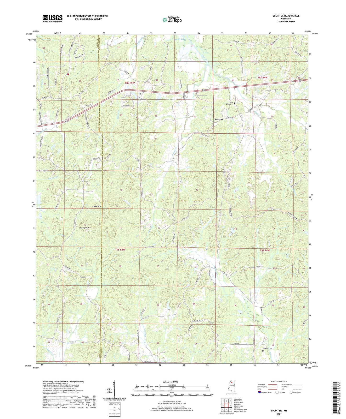
2021 topographic map quadrangle Splinter in the state of Mississippi. Scale: 1:24000. Based on the newly updated USGS 7.5' US Topo map series, this map is in the following counties: Lafayette, Panola. The map contains contour data, water features, and other items you are used to seeing on USGS maps, but also has updated roads and other features. This is the next generation of topographic maps. Printed on high-quality waterproof paper with UV fade-resistant inks.
Quads adjacent to this one:
West: Sardis SE
Northwest: Sardis Dam
North: Coles Point
Northeast: Oxford North
East: Oxford South
Southeast: Water Valley East
South: Water Valley West
Southwest: Shuford
Contains the following named places: Acree Hill Church, Bevely Church, Briscoe Pond Dam, Browning Cemetery, Browning School, Burgess, Burgess School, Burt School, Clear Creek Cemetery, Clear Creek Church, Coles Point Fire Department District 6, Crumblys Store, Harrisonville Church, Harrisonville School, Hudson Creek, Lafayette County Fire Department Station 15 Hwy 6 W / Clear Creek Rd, Lowe Mountain, Moore Pond Dam, Orwood, Orwood School, Rock Hill School, Sand Spring Church, Shady Grove Church, South Hopewell Church, Splinter, Splinter School, Spring Hill School, Tatum Pond Dam, Terrapin Mountain, Wallace, WMAV-TV (Oxford), ZIP Code: 38673