MyTopo
Millry South Alabama US Topo Map
Couldn't load pickup availability
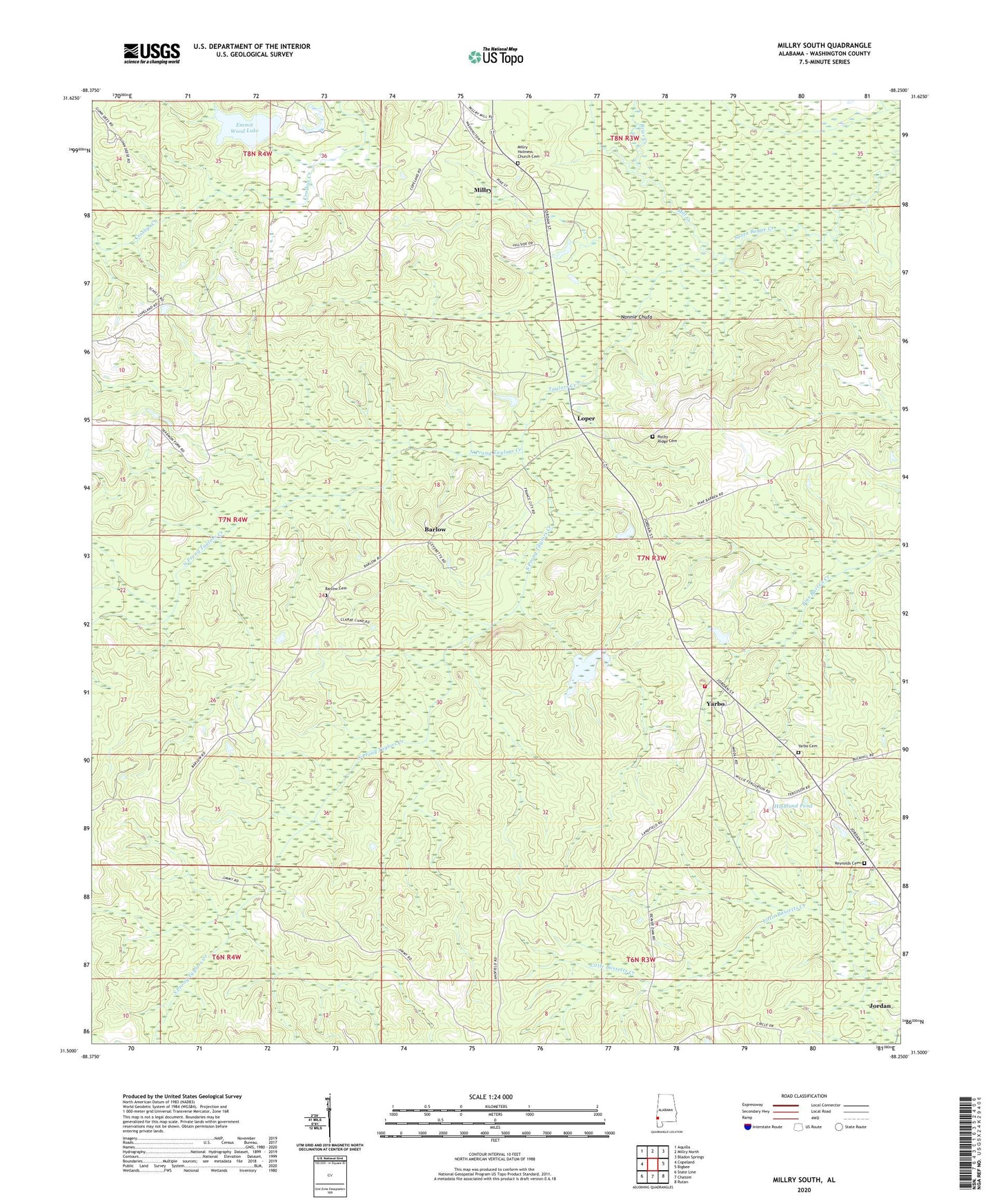
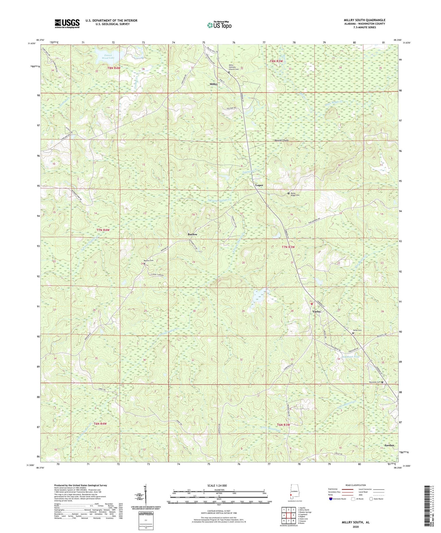
2024 topographic map quadrangle Millry South in the state of Alabama. Scale: 1:24000. Based on the newly updated USGS 7.5' US Topo map series, this map is in the following counties: Washington. The map contains contour data, water features, and other items you are used to seeing on USGS maps, but also has updated roads and other features. This is the next generation of topographic maps. Printed on high-quality waterproof paper with UV fade-resistant inks.
Quads adjacent to this one:
West: Copeland
Northwest: Aquilla
North: Millry North
Northeast: Bladon Springs
East: Bigbee
Southeast: Rutan
South: Chatom
Southwest: State Line
This map covers the same area as the classic USGS quad with code o31088e3.
Contains the following named places: Barlow, Barlow Cemetery, Barlow Chapel Methodist Church, Barlow Church, Brier Creek, Cypress Pond Branch, Emmit Wood Lake, Fitee, Highland Pond, King Chapel Church, Knight, Loper, Loper School, Mill Creek, Nannie Chufa, New Bethel Church, North Prong Taylors Creek, Reynolds Cemetery, Reynolds Church, Rocky Ridge Baptist Church, Rocky Ridge Cemetery, Rocky Ridge School, South Prong Taylors Creek, Taylors Creek, Washington County Public Lake Dam, Yarbo, Yarbo Assembly of God Church, Yarbo Cemetery, Yarbo Volunteer Fire Department, ZIP Code: 36558