MyTopo
Shady Grove Mississippi US Topo Map
Couldn't load pickup availability
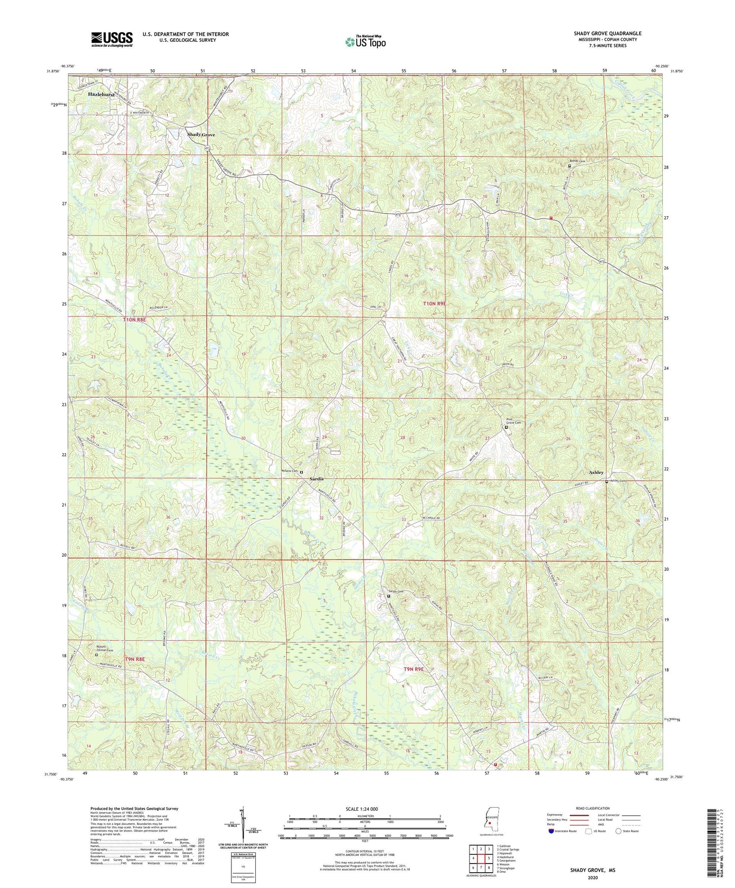
2024 topographic map quadrangle Shady Grove in the state of Mississippi. Scale: 1:24000. Based on the newly updated USGS 7.5' US Topo map series, this map is in the following counties: Copiah. The map contains contour data, water features, and other items you are used to seeing on USGS maps, but also has updated roads and other features. This is the next generation of topographic maps. Printed on high-quality waterproof paper with UV fade-resistant inks.
Quads adjacent to this one:
West: Hazlehurst
Northwest: Gallman
North: Crystal Springs
Northeast: Hopewell
East: Georgetown
Southeast: Oma
South: Stronghope
Southwest: Wesson
This map covers the same area as the classic USGS quad with code o31090g3.
Contains the following named places: Anding Branch, Ashley, Ashley Cemetery, Bethel Cemetery, Bethel Church, Bethel Volunteer Fire Department, Eastern Star Church, Mullens Cemetery, Pine Grove Cemetery, Russell Creek, Russell-Tillman Cemetery, Sanderson Farms Pond Dam, Sardis, Sardis Baptist Church, Sardis Branch, Sardis Cemetery, Shady Grove, Shady Grove Baptist Church, Stronghope Volunteer Fire Department, Supervisor District 2, Wolf Pen Branch