MyTopo
Stubbs Island Mississippi US Topo Map
Couldn't load pickup availability
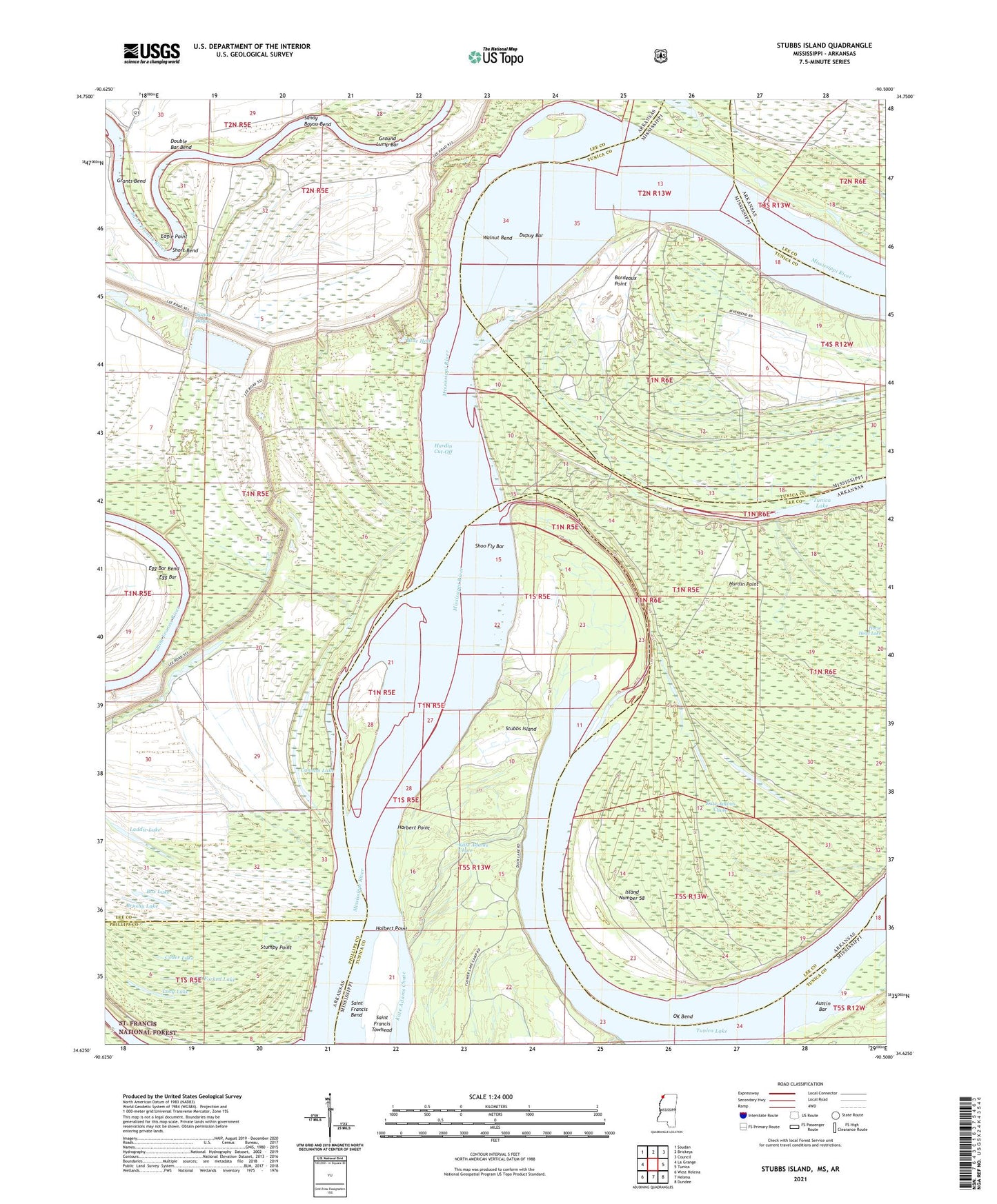
2021 topographic map quadrangle Stubbs Island in the states of Arkansas, Mississippi. Scale: 1:24000. Based on the newly updated USGS 7.5' US Topo map series, this map is in the following counties: Tunica, Lee, Phillips. The map contains contour data, water features, and other items you are used to seeing on USGS maps, but also has updated roads and other features. This is the next generation of topographic maps. Printed on high-quality waterproof paper with UV fade-resistant inks.
Quads adjacent to this one:
West: La Grange
Northwest: Soudan
North: Brickeys
Northeast: Council
East: Tunica
Southeast: Dundee
South: Helena
Southwest: West Helena
Contains the following named places: Austin Bar, Below Walnut Bend Dikes, Blue Hole, Blue Point, Blue Point Landing, Bordeaux Point, Box Lake, Brushy Lake, Cannon Lake, Cober Lake, Double Bar Bend, Dupuy Bar, Eagle Point, Egg Bar, Egg Bar Bend, Forked Lake, Grants Bend, Grants Landing, Ground Lump Bar, Halbert Point, Harbert Landing, Harbert Point, Hardin Cut-Off, Hardin Point, Island Number 58, Jentry Lake, Kate Adams Chute, Lacy Lake, Laddie Lake, Mound Place Landing, OK Bend, Osborn Landing, Saint Francis Island Landing, Saint Francis Island Lodge, Sandy Bayou, Sandy Bayou Bend, Shoo Fly Bar, Short Bend, Smith Lodge, Stubbs Island, Stumpy Point, Tate Landing, Tate Lodge, Township of Hardy, Walnut Bend, Walnut Bend Revet, Whitehall Crevasse